Rocky Mountain National Park is an hour’s drive from our house. No matter the time of year, it’s spectacular. According to the National Park Service website, it’s “415 square miles [that] encompass and protect spectacular mountain environments. . . . Trail Ridge Road . . . crests at over 12,000 feet including many overlooks to experience the subalpine and alpine worlds – along with over 300 miles of hiking trails, wildflowers, wildlife, starry nights, and fun times. In a world of superlatives, Rocky is on top!”
If you don’t count the handful of times we hiked into RMNP the back way, we have visited the park exactly twice during the past ten years. In the early Colorado years, the trips were more frequent, and we especially enjoyed taking out-of-state visitors to the park. Now it’s simply a matter of too many people and too much traffic congestion, particularly when you’re limited to visiting on the weekends.
Since retiring, the weekend rule no longer applies, so this most recent outing on a Thursday was especially sweet. My sister, Janice, was in town and wanted to see fall colors, so we headed up the hill to spend the day in RMNP. It truly was an opportunity to rediscover this national park jewel.
Fall River Road
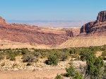
From Estes Park, there are two routes into the park that eventually converge at the Alpine Visitor Center. We opted for Fall River Road, which was the original road until Trail Ridge Road was constructed back in the 1930s. You can check out the details at the Fall River Road information site. The views from this 11-mile dirt road are breathtaking, and we stopped at nearly every available opportunity to soak up the sights and snap a few photos.


Alpine Visitor Center
The 11,796 feet elevation Alpine Visitor Center, located at the endpoint of the Fall River Road, is a popular stopping point for visitors to the park. In addition to the usual comfort amenities and the obligatory gift shop, it’s a short 1/4 mile jaunt uphill to even more awesome views. Definitely worth the trek, but not for the unprepared. The high elevation, plus cool temperature (50 degrees) and gusty winds (50 mph?) transformed a short stroll into a blustery battle with the elements.


West Side of Trail Ridge Road
Continuing west beyond the Alpine Visitor Center, the road starts to descend. The next major stopping point is Milner Pass, elevation 10,759 feet at the continental divide, where Janice and I had a déjà vu experience. We recalled having our picture taken at that very spot during a family vacation many moons ago, so we decided to recreate the photo with the help of a friendly and willing volunteer photographer. Note that the early photo was taken in early June vs. the current one in late September before the snow flies.


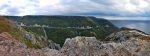
Poudre Lake, also located at Milner Pass and shown in the picture below, forms the headwaters of the Cache la Poudre River, which flows eastward through Fort Collins and beyond, and is also very near the headwaters of the Colorado River, one of the principal rivers of the southwest U.S. and northern Mexico.
From Milner Pass, we continued westward on Trail Ridge Road.


Our turnaround point on the west side of the park was the Holzwarth Historic Site, a place that I had not previously visited. It’s a stunning location in the valley, surrounded by high peaks and bisected by the Colorado River. The Holzwarth family moved from Denver to homestead the property in 1917 and began guest ranch operations in 1919. The place was purchased by the Nature Conservancy in 1974 and turned over to the National Park Service in 1975. Today the site consists of a few cabins and other outbuildings, along with informational displays about its history.


Heading for Home
We made one more stop along Trail Ridge Road before exiting the park.
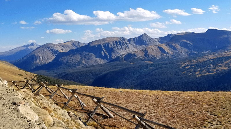
View from Trail Ridge Road
Eight hours after we left, we were home. It was a fantastic day!
Discover more from Just Passing Through
Subscribe to get the latest posts sent to your email.