All three are found along the California coast, but what else do they have in common? Answer: unique and profound challenges to their future survival. Lighthouses, coastal dunes, and monarch butterflies all need our help! Read on to learn more . . . .
Lighthouses
With GPS and other contemporary navigational technology, old-style lighthouses are functionally obsolete, and many have been abandoned by the U.S. Coast Guard due to the high cost of upkeep. As a result, many of these iconic structures have fallen into disrepair. Lighthouse Digest publishes a “Doomsday List” of America’s most endangered lighthouses, and about 50 of the crumbling structures are identified in the current report.
On a positive note, Congress passed the National Historic Lighthouse Preservation Act in 2000 to facilitate the transfer of the vacated facilities to entities that would have the wherewithal to restore the buildings and make them available to the public. As of 2014, 113 lighthouses had been sold or transferred, with many more still awaiting new owners.
We toured two lighthouses during our time in California and gained an appreciation for how much money and effort it takes to bring these old buildings back to life. And the work is never done – the need for funds and dedicated volunteers is huge and ongoing.
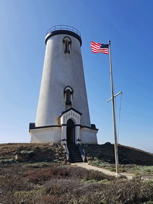
Point San Luis Light Station
Located at the tip of San Luis Bay, the Point San Luis Light Station has functioned as a nautical beacon since 1890. The original lighthouse looks like a Victorian home that, in fact, also served as living quarters for the main keeper and his family for many years.
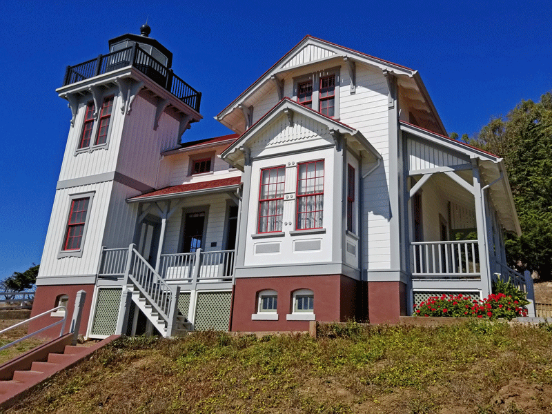
Decommissioned in 1974, the former light station is accessible to the public only by docent-led tours. We met our group a few miles away at a parking lot in Avila Beach and traveled to the site by van. Views en route to the lighthouse were spectacular!

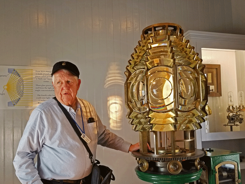
This was our first guided tour of a lighthouse, and Bob, our docent, knew his stuff. We learned, for example, about the six sizes of Fresnel lenses installed in U.S. lighthouses during the 1800s and that the 4th order lens at Point San Luis (shown in the photo above) was visible up to 20 miles away.
We also learned that each light station had three unique signatures that allowed mariners to identify their location. Daymarks were the physical characteristics of the lighthouse – no two were exactly alike. Second, the fog signal – a five second blast followed by 35 seconds of silence for Point San Luis. And finally, the light pattern – Point San Luis deployed a flash every 30 seconds that alternated between red and white. A simple, but effective, methodology for determining one’s location before the advent of radar and GPS.
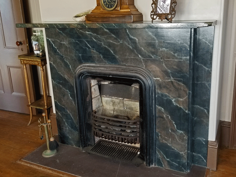
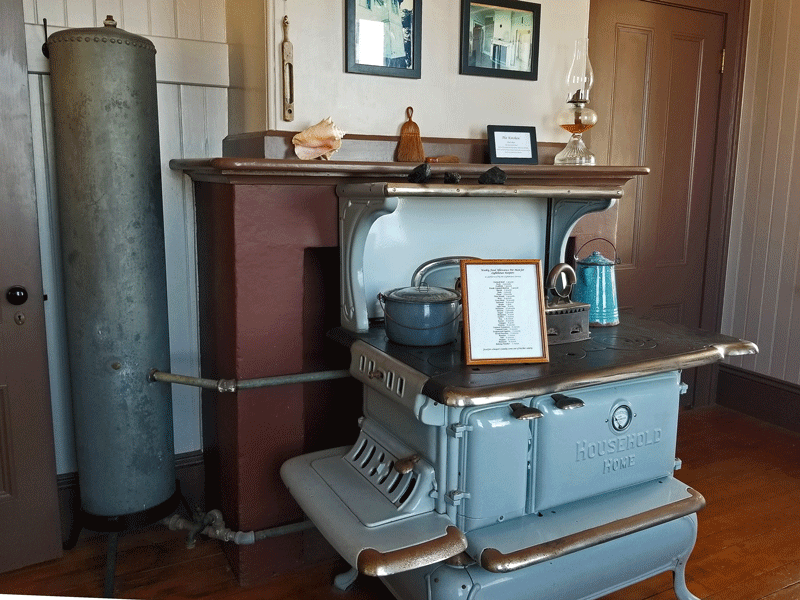
Our 60 minute tour included the residence attached to the light station. Bob pointed out that most of the original finishes and furnishings were lost over the years but had been re-created in the same style during the restoration process. The lone exception was the fireplace surround and mantel (shown in the photo gallery below) that features the original tiles.


The Coast Guard still operates a light station at the site, with a pattern of one second on, four seconds off.
We thoroughly enjoyed our tour! Just be sure to make reservations ahead of time, because there’s no option for signing up when you arrive.
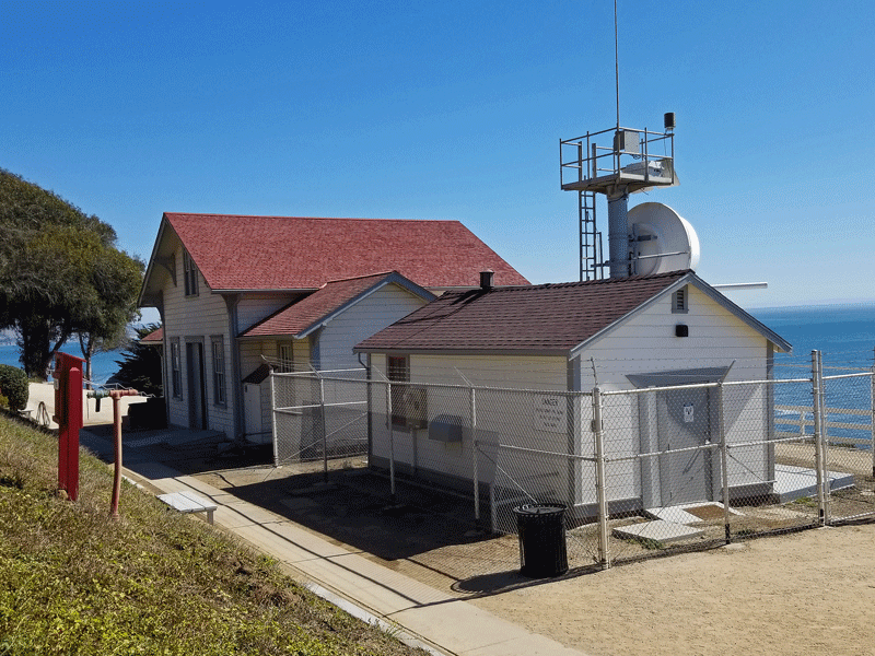
Piedras Blancas Light Station
The Piedras Blancas Light Station, located a few miles of San Simeon and the Hearst Castle, was first illuminated in 1874 (white light every 15 seconds), and the fog signal (two seconds on, 20 seconds off) was added in 1906. Operations ceased in 1948 after an earthquake severely damaged the lighthouse, rendering it structurally unsound. Efforts to restore both buildings and grounds began in 2001.
We needed a little help from Google to find out how to sign up for a tour, which is only offered a few times a week. Instructions were clear – do NOT meet at the lighthouse, instead assemble at a defunct motel 1.5 miles away, so we did. Other customers and the organizer showed up over the course of the next 15 minutes, and then we all caravaned to the lighthouse in private vehicles.
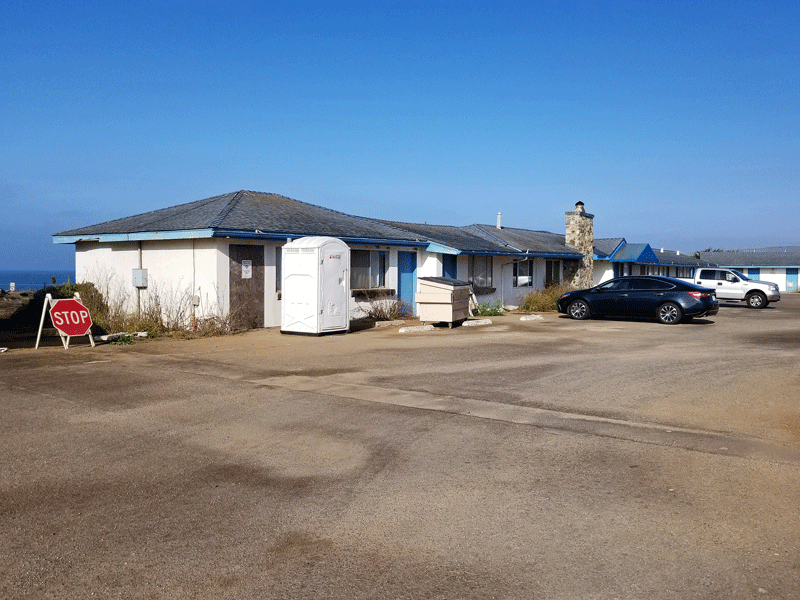
Meeting place for the tour 
Our enthusiastic tour guide 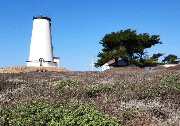
Piedras Blancas Light Station 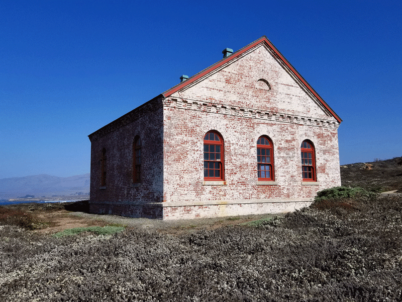
Fog signal building
The lighthouse was originally 100 feet tall and housed a first order (i.e., the largest size) Fresnel lens. After the 1948 earthquake, the upper levels were removed, including the light, which was carefully disassembled and moved to the nearby town of Cambria, where it’s prominently displayed on Main Street.
Piedras Blancas Lighthouse 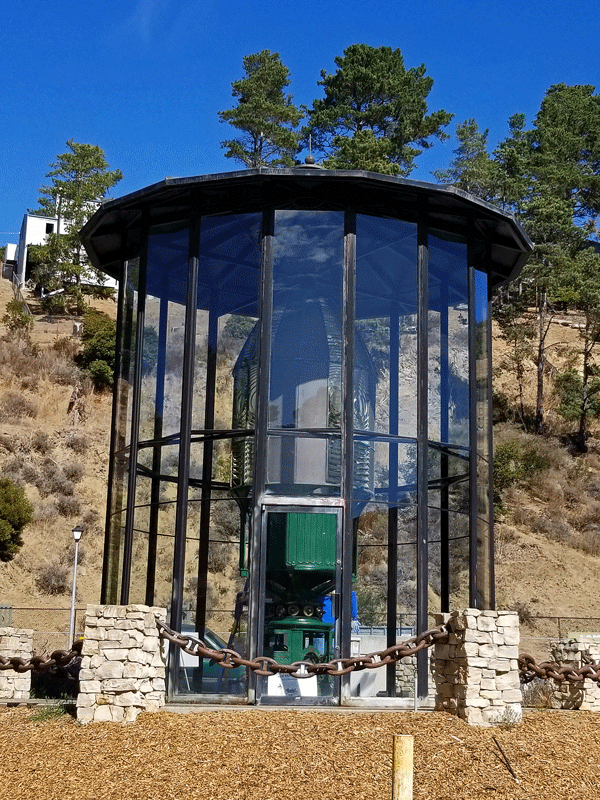
Original Fresnel lens 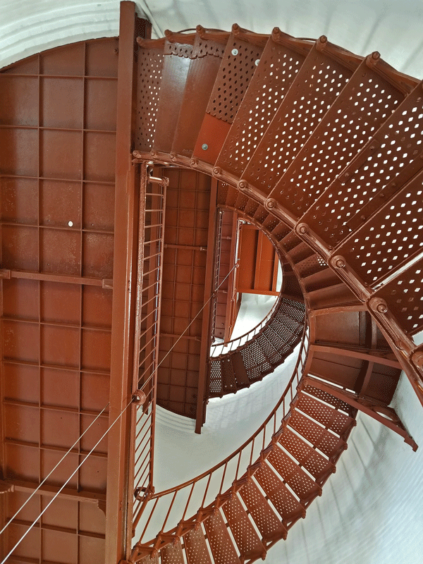
Staircase inside the lighthouse
A substantial portion of the tour was around the grounds surrounding the lighthouse. The area hosts large numbers of elephant seals, sea lions, sea otters, and other marine mammals, including migrating whales. Biologists use the site to conduct an annual count of gray whales as they pass through on their way to Alaska in the early spring.
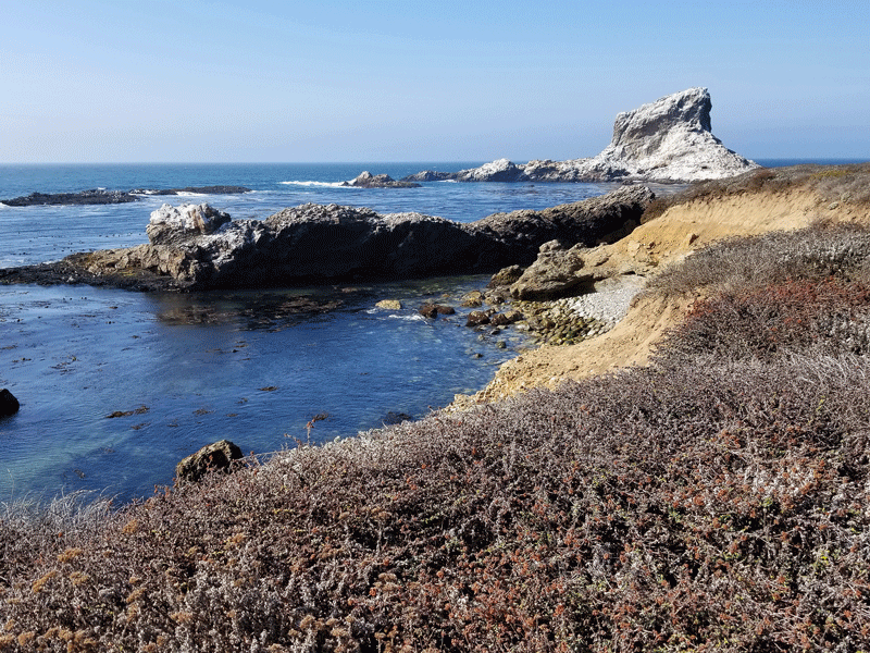
The rock for which Piedras Blancas was named 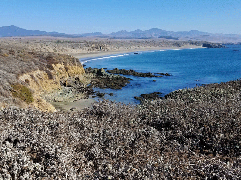
Beaches where elephant seals congregate
Although advertised as a two hour tour, ours was about half an hour longer – a definite bonus. We would recommend this tour without hesitation!
Coastal Dunes and Oso Flaco Lake
The Oso Flaco Lake hike is short, easy, and packed with interesting features. We are grateful to our good friend, John K, for adding it to our list of things to do along the central coast of California.
We were aware that the hike was located in the Guadalupe-Nipomo Dunes, an 18-mile stretch of coastline that contains the largest dune system south of San Francisco and the second largest in all of California. Eager to learn more, our plan was to visit the Dunes Center in the nearby town of Guadalupe before heading to the trailhead. Unfortunately, the center is closed on Monday’s and Tuesday’s, so we missed out.

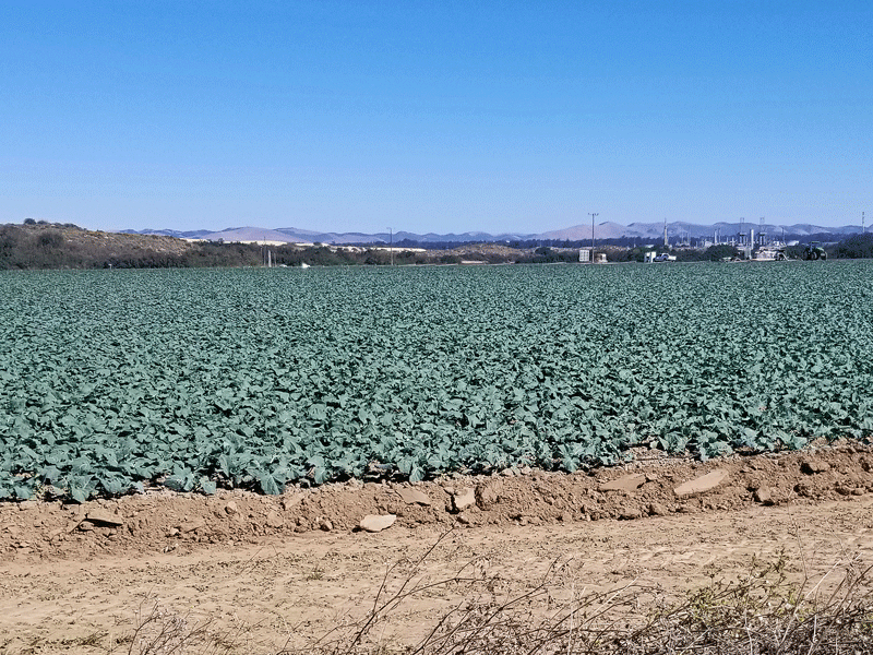
We drove through miles of truck farms to reach the trailhead, which was tucked away at the end of a lonely road. The landscape changed dramatically once we set off on the trail.
View looking southeast from the trailhead 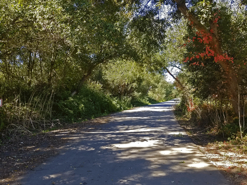
View looking northwest from the trailhead
The boardwalk trail passes through two environments. First is Oso Flaco Lake, a 75-acre freshwater lake that offers refuge for a wide variety of local and migrating birds. The second section traverses the dunes toward the coast.

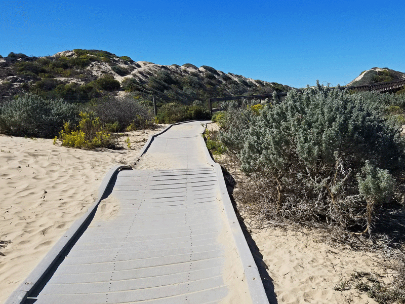


Upon reaching the end of the trail, we continued walking on the secluded stretch of beach for another mile or so before turning back and retracing our steps. An easy walk with much to see along the way – five stars!
So what are the challenges? California’s coastal dunes were misunderstood and mismanaged for many years. Iceplant, European beech grass, and other non-native, invasive plants were introduced to stabilize the dunes, but they provide insufficient food and shelter for native wildlife and interfere with the natural movement and development processes that sustain a healthy dunes ecosystem. Over time, the dunes become a wasteland due to loss of plant diversity and inability to support wildlife.
There is good news, however. Efforts dating back as far as the 1980s to restore coastal dunes to their natural state have been successful. Coalitions of public entities, private organizations, and concerned individuals are making a difference, tackling a few hundred acres at a time. There is much more to do, however, so these projects will need ongoing support for the foreseeable future.
Monarch Butterflies
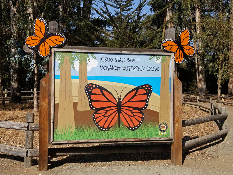
Monarch butterflies begin arriving at Pismo Beach Butterfly Grove, the largest overwintering site in California, every year in late October. It’s a short drive from Morro Bay, so we decided to take a look.
During their four month stay, the butterflies live in a state of semi-hibernation within a grove of eucalyptus trees at Pismo State Beach. Volunteers are available to provide information and answer questions about the winged insects, and visitors can get a close up view of clustering butterflies through spotting scopes.
It is a magnificent sight!
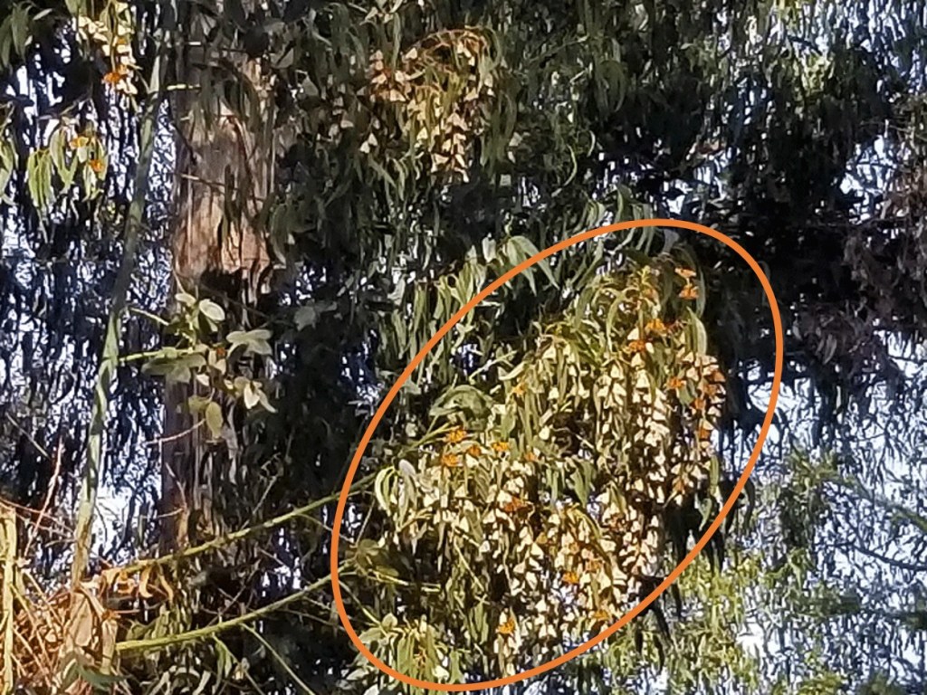
Our unmagnified view of a cluster 
Close up view of a comparable monarch cluster (www.bloomingbutterflies.org)
During a talk to learn more about the butterflies and their migration, we learned that monarchs living west of the Rocky Mountains (Western Monarchs) winter in California and Baja California. All others in North America are Eastern Monarchs, and they head to other locations in Mexico for the winter.

And now the bad news . . . .
Western monarch butterfly numbers have dropped more than 99% since the 1980s. That’s not a typo! Scientists believe they have reached a threshold known as quasi-extinction. The chart below shows the dramatic decline in the numbers of monarchs overwintering at the Pismo Beach Butterfly Grove since 1990.

There are multiple reasons for the decline, including loss of habitat, widespread use of pesticides, and climate change. It’s mind-boggling and extremely alarming to absorb the numbers and admit the reality that we are on the brink of losing these little winged treasures. In an effort to stabilize the population in the short term, the Xerces Society has published a call to action that outlines steps being taken in California: https://xerces.org/publications/fact-sheets/how-you-can-help-western-monarchs.
I’m hopeful.
Discover more from Just Passing Through
Subscribe to get the latest posts sent to your email.


