Our visit to Death Valley got off to an auspicious start with the most spectacular moon rise I have ever seen. Ever.
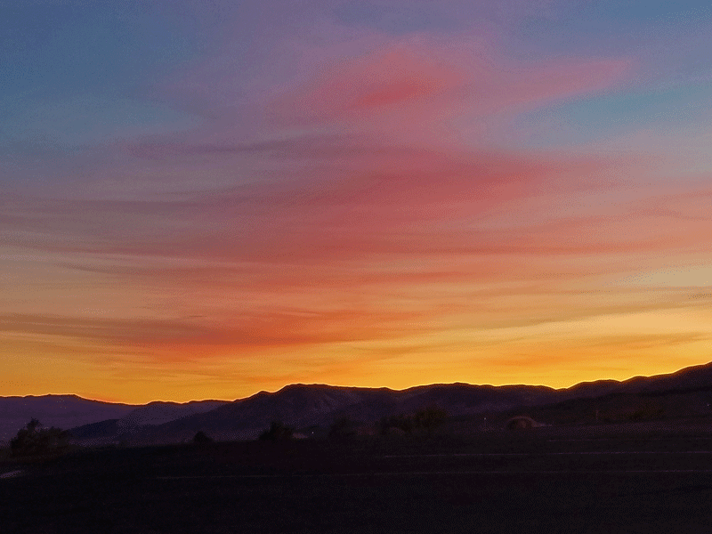
As we entered the park from the west, the sun had just set behind us. A few minutes later, beautiful bands of pink and blue appeared low above the horizon in front of us as we traveled east. (I later learned that this common phenomenon is called the Belt of Venus.) Just as those colors were peaking, the full moon was also peeking out from the mountaintops in the midst of the blue band of color. Oh me, oh my!
We soaked it in over the next few minutes until the colors faded away. No photos of the magical experience, as I was driving with no place to pull over. However, we stopped at Father Crowley Vista Point several miles up the road and turned our attention westward to experience the last gasp of the beautiful sunset. Not too shabby!
The rest of our experience at Death Valley was equally surprising and rewarding. We knew it was a bone dry and unbelievably hot desert but didn’t realize how massive the national park is. At 3+ million acres, it’s the largest in the lower 48 and half again the size of Yellowstone – bigger than the combined area of Delaware and Rhode Island.
Another revelation was that the various attractions within the park were totally different from one other – the terrain, the landscapes, the vegetation, and the elevation. We had no idea it would be so interesting!
The photo gallery below is a preview. Keep reading for more details and pictures.
Colorful mineral deposits 
Wetlands 
Scenic views 
Slot canyons 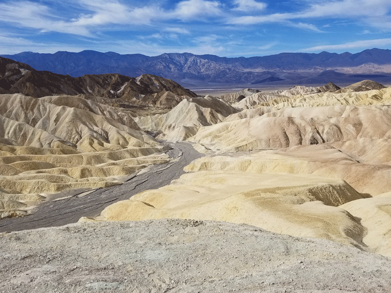
Badlands 
Salt flats
We had company for our visit to Death Valley! Long time friends and travel partners, Marlene and Steve. We first vacationed with them in 1982 and have been exploring new places together ever since.
You can check out their blog post about Death Valley by visiting https://ruppsooby.com/2019/11/30/death-valley-california/.
Mosaic Canyon
A nice hike with narrow canyon walls that have been polished into smooth marble in places.
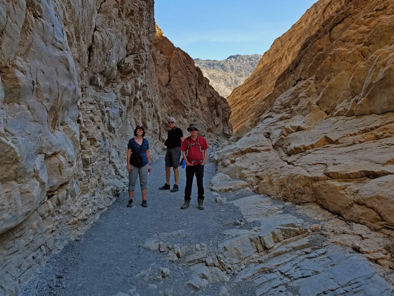
Marlene, Steve & Bill 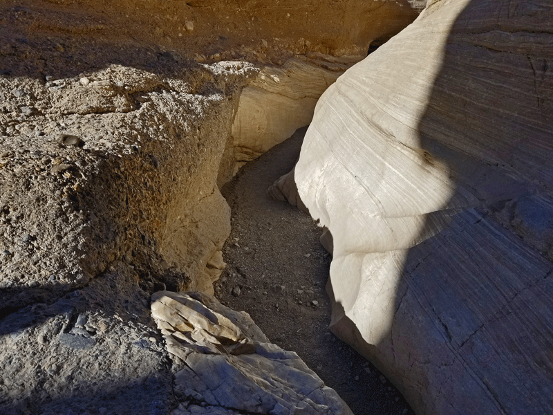
Narrow spot on the trail – note the polished marble walls 
Marlene navigating slick marble on the path 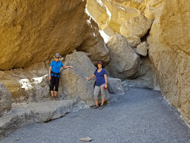
Boulders blocking the trail 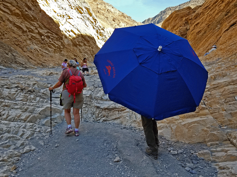
A beach umbrella? 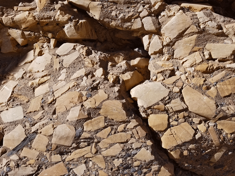
Natural mosaics embedded in the rock 
Shall we take the high road or the low road?
Mesquite Flat Sand Dunes
They aren’t the tallest sand dunes in Death Valley, but they are the most accessible. We parked nearby and explored on foot. Not a lengthy visit, because we had more places to see.


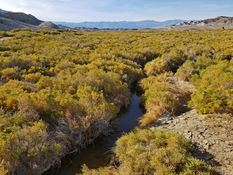
Salt Creek
This area is home to the Salt Creek pupfish, a tiny silver-colored fish found only in Death Valley. Pretty sure the vegetation is called pickleweed.
Harmony Borax Works
Borax was mined and processed in present day Death Valley National Park between 1883 and 1888. Mule teams were used to haul the borax to the Mojave railhead – a 165 mile, ten day grueling journey over unforgiving terrain.

One of only two remaining twenty mule team wagons 
Section of former borax processing plant
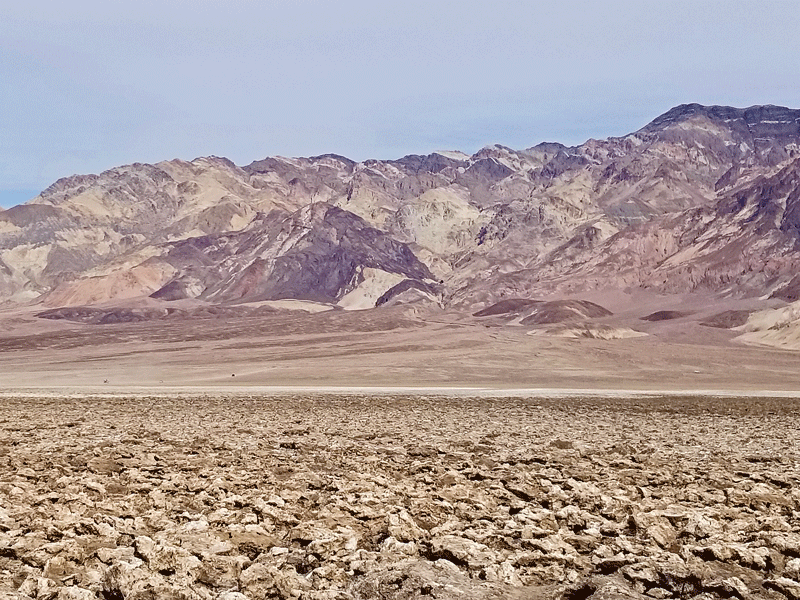
Badwater Basin
At 283 feet below sea level, Badwater Basin is the lowest point in North America and features around 200 square miles of salt flats. Bill took a little taste and confirmed that the white substance was . . . salt.
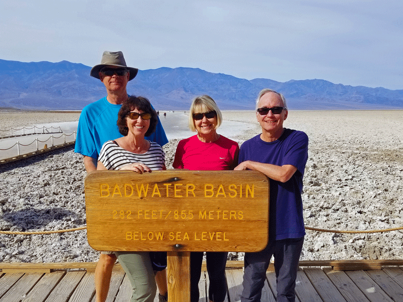
Steve, Marlene, Carol & Bill Steve warming up for the Badwater 100 Ultramarathon 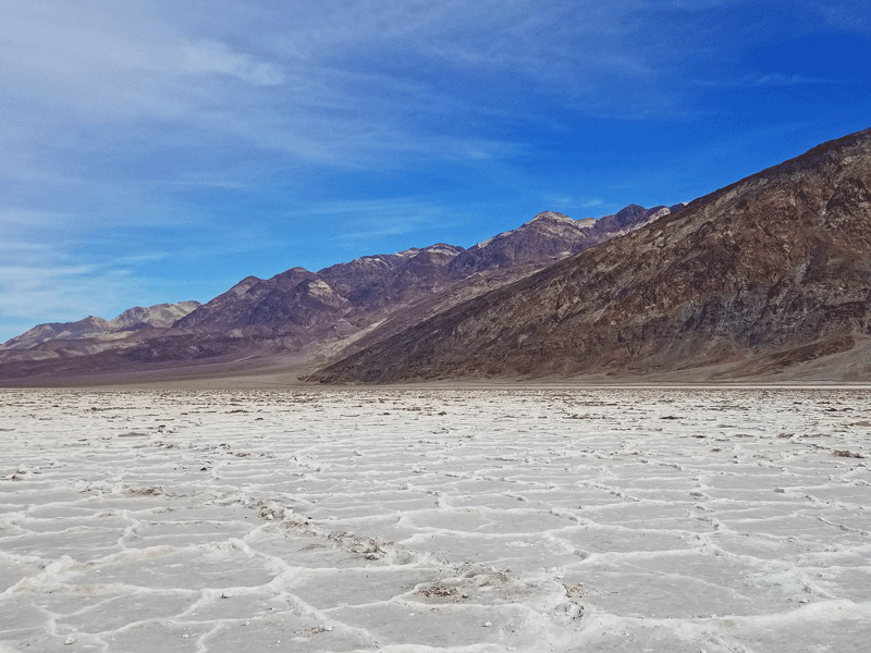
Note the interesting salt patterns 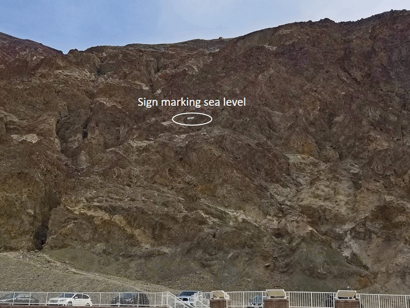
We’re at 283 feet below sea level
Natural Bridge Canyon
Another canyon and more rocks. The natural bridge was interesting, but the highlight was the debate about whether we could make it up and over the “almost impassable 15-foot vertical cliff” that stood between us and the next section of the trail. (We turned back.)

Natural bridge 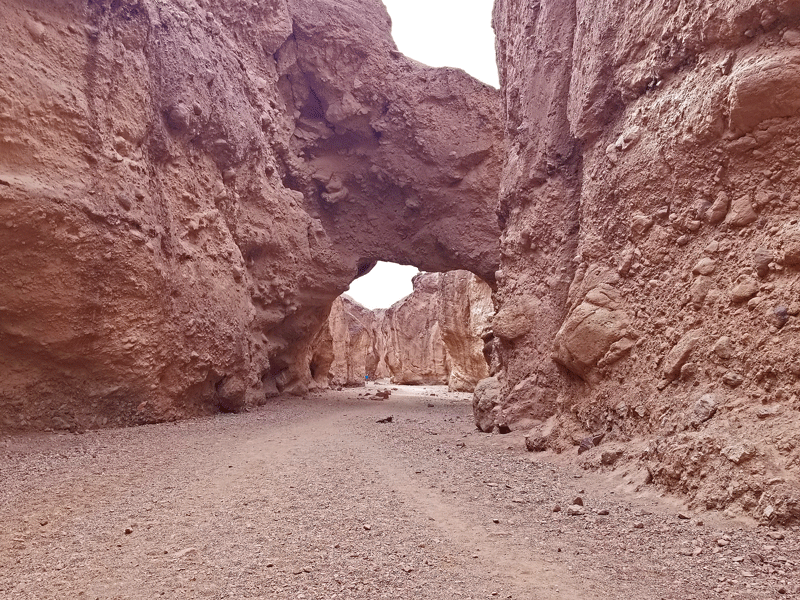
Natural bridge from the other direction 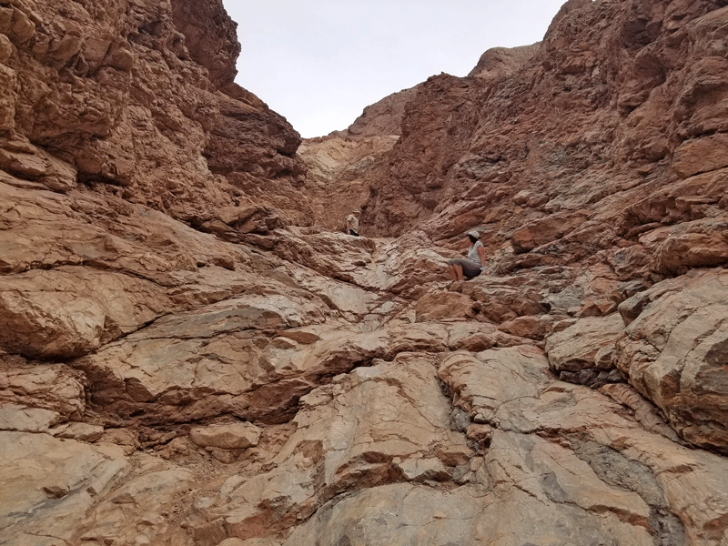
End of the trail . . . for us 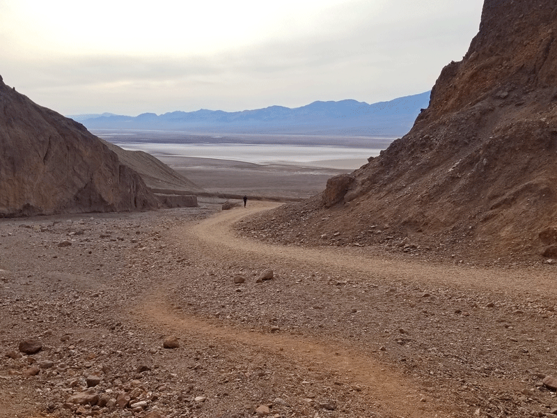
Glimpse of the salt flats
Devil’s Golf Course
Leave your clubs at home – Devil’s Golf Course is comprised of salt crystal sculptures. It was named after a description in the 1934 Death Valley guidebook: “Only the devil could play golf” here.

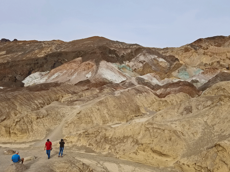
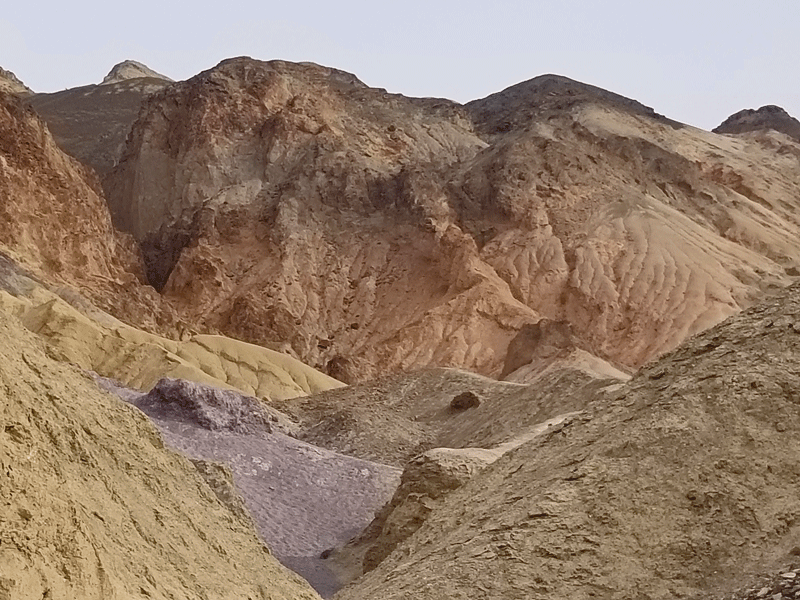
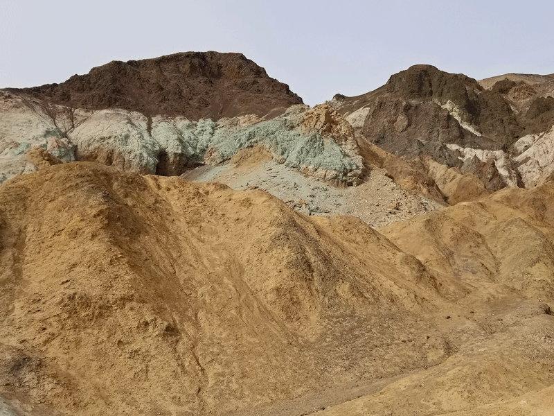
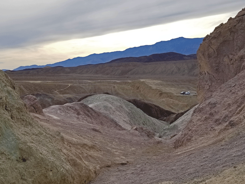
Artist’s Palette
Colorful reds, pinks, purples, greens, yellows, and browns were created from the oxidation of iron, manganese, and mica. Driven to see what lay around the next bend, we couldn’t stop wandering on the many walking paths.


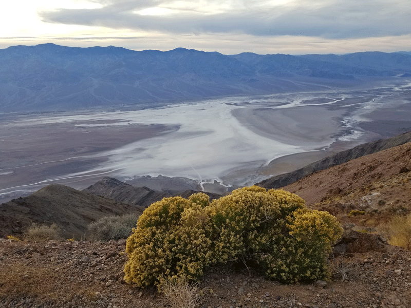
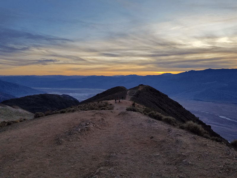
Dante’s View
This easily accessible overlook (elevation 5,476 feet) features breathtaking views of the Panamint Mountains in the distance and the salt flats at Badwater Basin (elevation -283 feet). A beautiful spot to watch the sunset, but worth the drive no matter the time of day.

Marlene perched at cliff’s edge 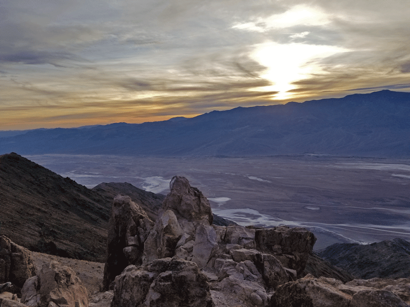
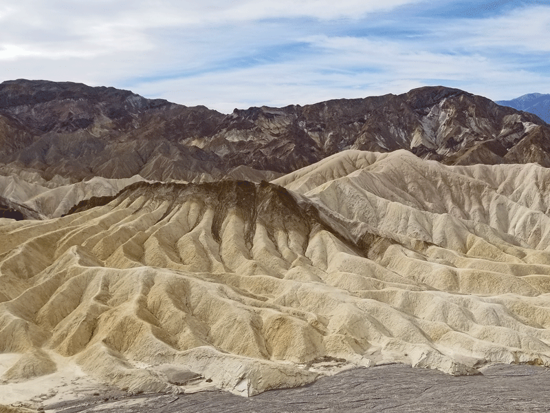
Zabriskie Point
Fun fact – the photo on the cover of U2’s Joshua Tree album was shot at Zabriskie Point, which does not contain a single Joshua tree but offers sweeping views of the clay and mudstone badlands of Death Valley.

Is there any reason to visit Death Valley? I’ll let you be the judge! I know for a fact that we will be back for more.
Discover more from Just Passing Through
Subscribe to get the latest posts sent to your email.


Beautiful!
Sent from Marlene Rupp
>
LikeLiked by 1 person
Ohhh wow! A must visit for us too !
Artist’s point, the canyons, views & nature ! It has it all
The ‘beyond sea level’ made me smile, as we live like that almost our entire life her in the Netherlands 🤭🤣
LikeLiked by 1 person
Thanks for your comment – I’m sure you will love it, too!
LikeLike
Thanks for sharing another incredible adventure! It’s out of this world – literally. xo
LikeLiked by 1 person
Thanks for your comment, Mary. I think you would like it!
LikeLike
Stunning photos – we were there in 1989 – 30 years ago – can’t believe I’m admitting that!! Thanks for the memories!!
LikeLiked by 1 person
Super-Duper blog! I am loving it!! Will come back again. I am bookmarking your feeds also.
LikeLike