It truly felt like The Last Frontier as advertised on the state’s license plates. Remote, rugged, isolated . . . and incredible.
Our original itinerary didn’t include a trip above the Arctic Circle. We added it later, because well, we were just so close.
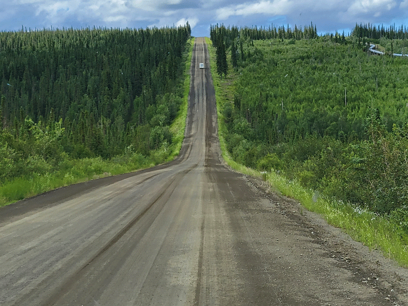
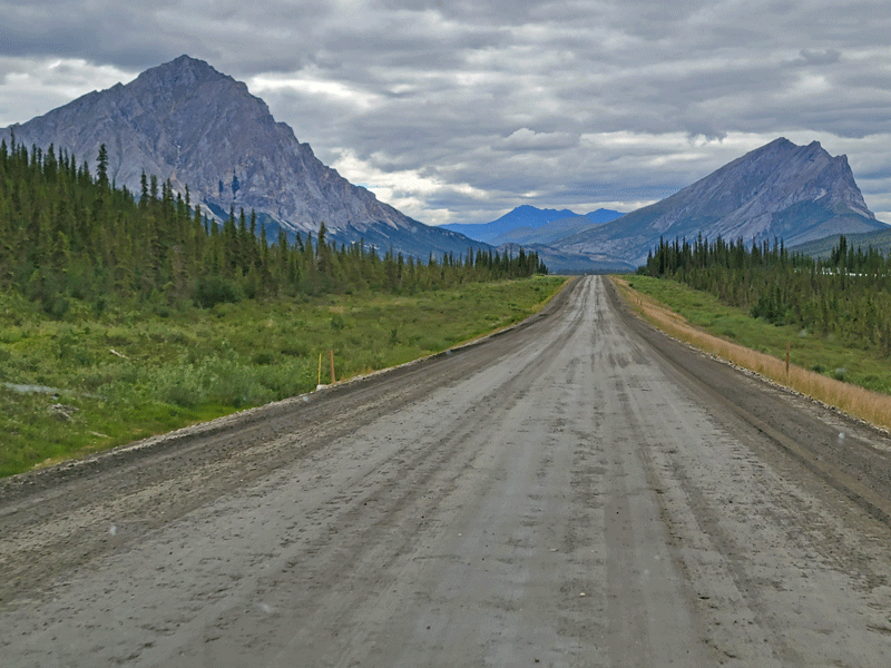
The Arctic Circle lies 198 miles north of Fairbanks, and visitors have several options for getting there. You can drive on a gravel road filled with gigantic potholes, but you’re on your own. There’s no cell signal or other services in the event of a break down or other emergency, and rental car companies say it’s a ‘no-no’ anyway.
The second option is a day trip up and back. You fly up on a bush plane, then take a shuttle van back to Fairbanks, or vice versa. It’s a long 16 hour day, but you get to see the sights from the air as well as at ground level. And you get the cool, “I Crossed the Arctic Circle” certificate, so you can check it off the list.
The third choice is to take a tour van up and spend a couple of nights at a truck stop in Coldfoot to do some sight-seeing, then fly back to Fairbanks.
We chose option #3, and we were not disappointed! Here’s a sneak peek to get the ball rolling.

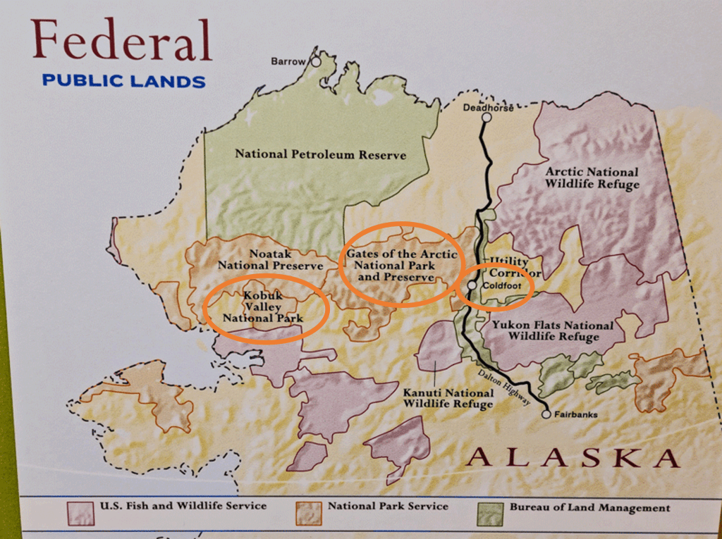
Kobuk Valley National Park 
Gates of the Arctic National Park 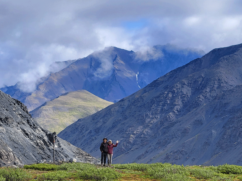
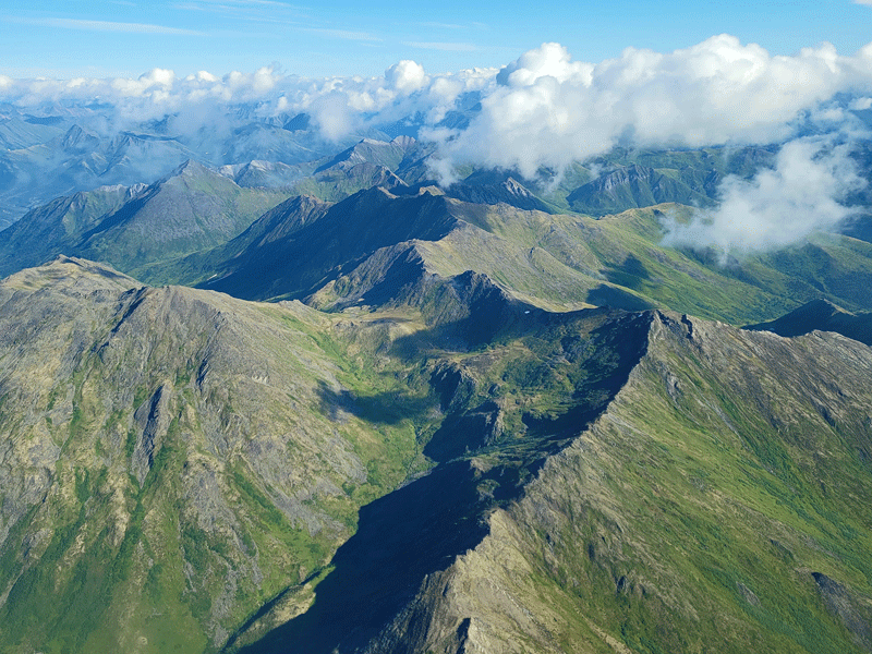
Brooks Range
Day 1 – Fairbanks to Coldfoot: More Interesting than We Expected
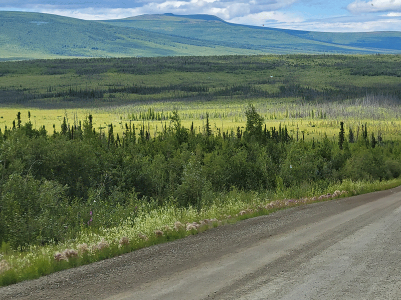
Not sure why I pictured an endless expanse of flat land devoid of trees and most vegetation, but on the contrary, it was hilly and lush.
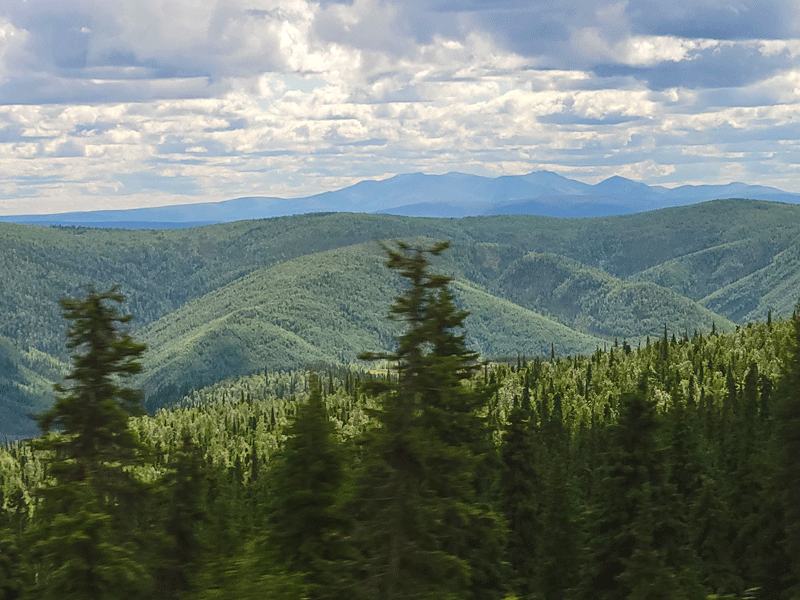
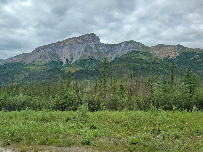
We left Fairbanks around 10:00 a.m. heading north, traveling first on the Elliott Highway, then on the Dalton Highway to Coldfoot Camp – a distance of 254 miles. (Locals are quick to point out that only tourists refer to Alaska highways by route numbers.)

Meet Mel, our enthusiastic and confident van driver and tour guide.
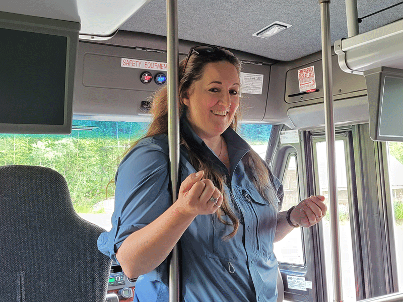
Over the course of the next eight hours, Mel taught us about the history, geography, biology, climate, geology and people of northern Alaska. All very interesting.
Her efforts were directed at Bill and me, as we were the only real newbies. There were four others on the tour van – two employees hitching a ride back from Fairbanks and two cyclists getting dropped off to resume a ride to the Arctic Ocean that had been interrupted a couple of months earlier.
Our first stop at the Arctic Circle Trading Post in Joy featured an interesting story about a family that had lived there for many years. Unfortunately, the trading post didn’t open this summer due to staffing issues, so it turned out to be a quick rest stop only.
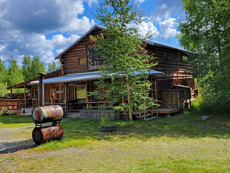
Trading post 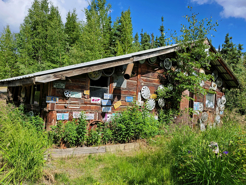
Old tire shop 
Lemonade stand is part of the history 
Worked as advertised but teeming with mosquitoes
Our next stop was at the Aleyeska oil pipeline to take a look and learn about the history, construction considerations and current status.
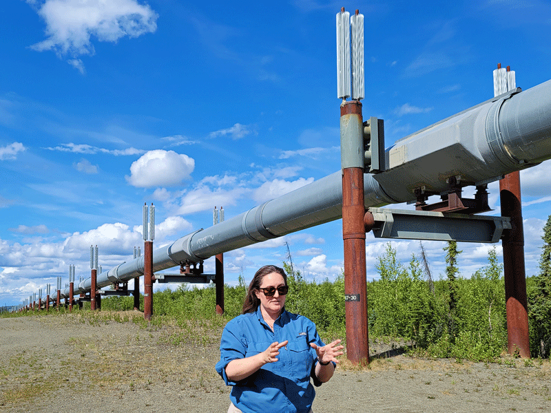

The Dalton Highway, which parallels the pipeline all the way to Prudhoe Bay, dates back to 1974, when it was built over a period of just five months. Its sole purpose was to support the logistics of building the northernmost 400 miles of the pipeline by transporting equipment, supplies and personnel across a vast area that had previously been inaccessible by road.
Today, the highway is still used for ongoing support of pipeline operations, but it’s also been open to the public since 1994.
Crude oil output from the North Slope peaked in 1988 and has declined by about 75% since. It takes 18 days for oil to travel through the pipeline from the beginning to its end point in Valdez.
Our third stop was at the Yukon River Camp. Normally, we would have eaten a late lunch there, but due to staff shortages this summer, the kitchen was closed. So it turned out to be just another bathroom break, although there were some cool shirts available for sale in the gift shop. (Thankfully, we had gotten a heads up that there was no food service along the way, so we brought our own provisions.)

Crossing the Yukon River 
Yukon River Camp
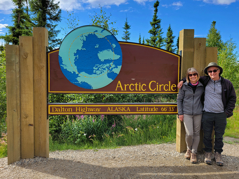
More scenic views were in store as we headed to our next stop at the Arctic Circle sign.

Mel left us at the Arctic Circle and headed back to Fairbanks, while we continued on with a different driver, arriving in Coldfoot about 1.5 hours later.
After settling into our room, getting something to eat and taking a short walk around the area, we called it a day.

Interesting lodging 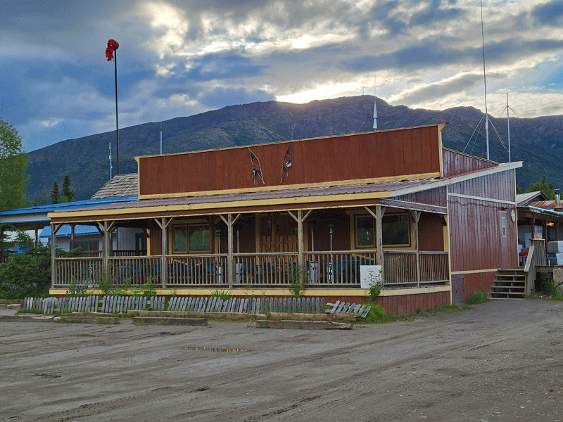
Tasty food at the restaurant
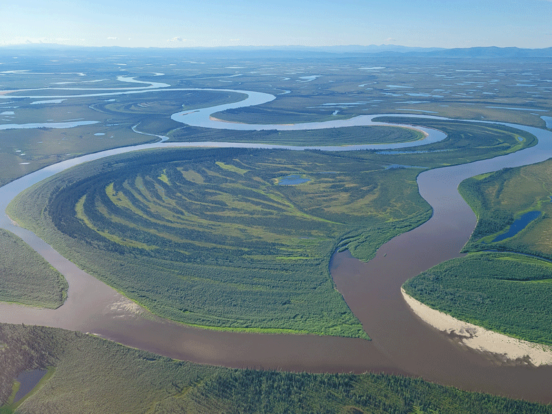
Day 2 – Kobuk Valley and Gates of the Arctic: Beautiful and Special
There are two national parks located above the Arctic Circle – Kobuk Valley and Gates of the Arctic. Both are remote, with no roads, no bridges, no signs, no facilities, no trails, and no services (including cell phones). None whatsoever. And therefore, almost no visitors.
In fact, Gates had the fewest visitors in 2019 among all national parks (~10,000 visitors), and Kobuk Valley came in with second fewest at ~15,000.
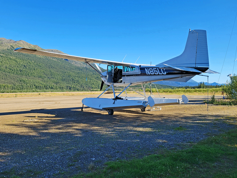
So how did we get there? We had two options – a manually propelled boat on the river (think kayak or canoe) or float plane. If you guessed float plane, then you know us pretty well.
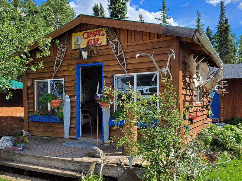
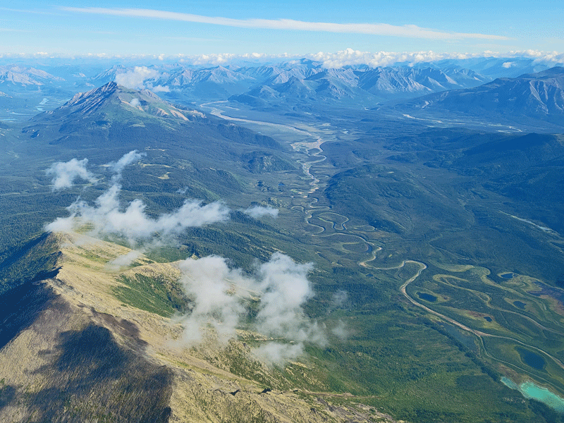
After exhaustive research to figure out the logistics, we booked an all day flight-seeing tour (with lake landings) with Coyote Air Service in Coldfoot to take us to both parks.
The map below shows the location of the two national parks in relation to Coldfoot.
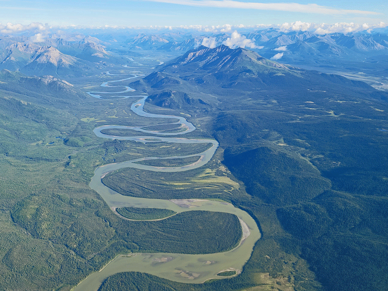
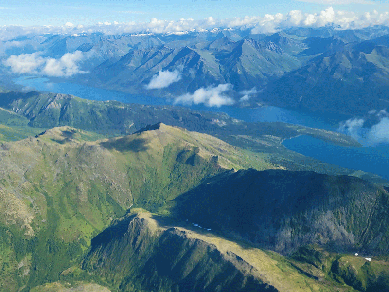
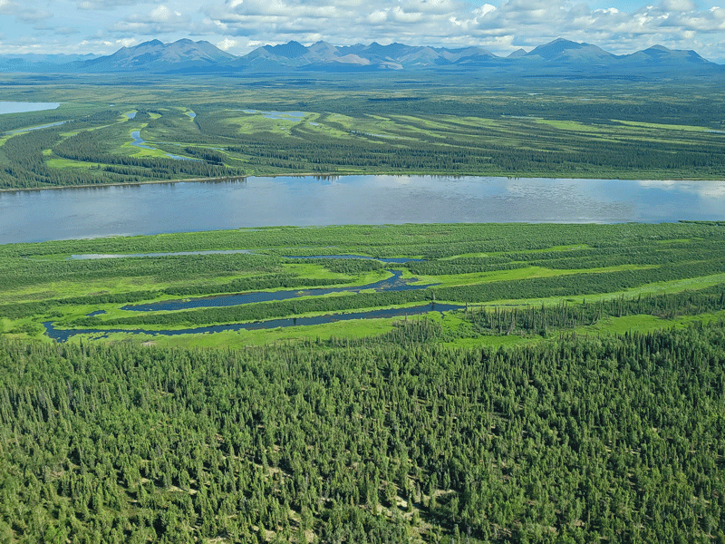
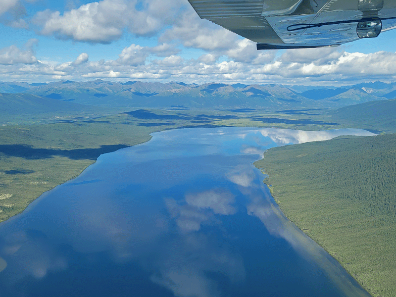
Lucky for us, it was a sunny day with good visibility, although strong winds were forecast for later in the afternoon. We traveled first to Kobuk Valley, about 200 nautical miles to the west.


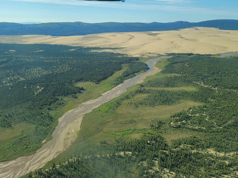
Sand dunes in the distance 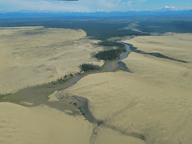
Sand dunes up close
After landing on a good-sized lake, we were surprised when we stepped ashore to find ourselves ankle-deep in soggy terrain.


“Throughout the Arctic, there are wetlands and bogs that hinder walking. Areas of tussocks – basketball-sized clumps of sedge surrounded by watery moss – are particularly aggravating. Waterproof boots with good ankle support are essential.” (quote from Dalton Highway visitor guide)
A closer look at the ground 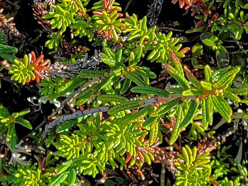
With all that water, you might be wondering about the mosquito situation. There were hordes of the pesky insects! Not exactly the tranquil nature experience we anticipated.
On a related note, this boggy area only receives about 10″ of annual precipitation – technically, it’s a desert. Permafrost just underneath the surface prevents rain and snowmelt from being absorbed, so water just sits atop the ground.

Our pilot, Danielle, adding more fuel so we can make it back to Coldfoot
After about 20 minutes, we were back on the plane headed toward Gates of the Arctic.
Different plant zones are due to varying depths of permafrost – beautiful patterns 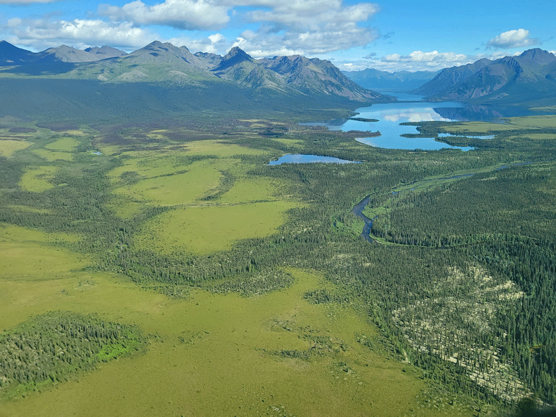
Now we know – those light green patches are bogs 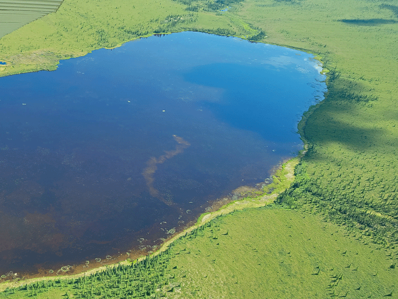
Moose tracks in the lake – you can see its head (barely) if you look closely 

Interesting colors near the shoreline 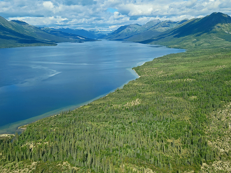
This is the lake where we landed in Gates of the Arctic
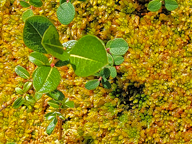
The dry ground here was a welcome change compared to the Kobuk wetlands. It was easier to walk around and explore our surroundings, so we did. You can see the difference in the terrain and plant life in the photo below.

Vegetation is very different here than our landing spot in Kobuk Valley 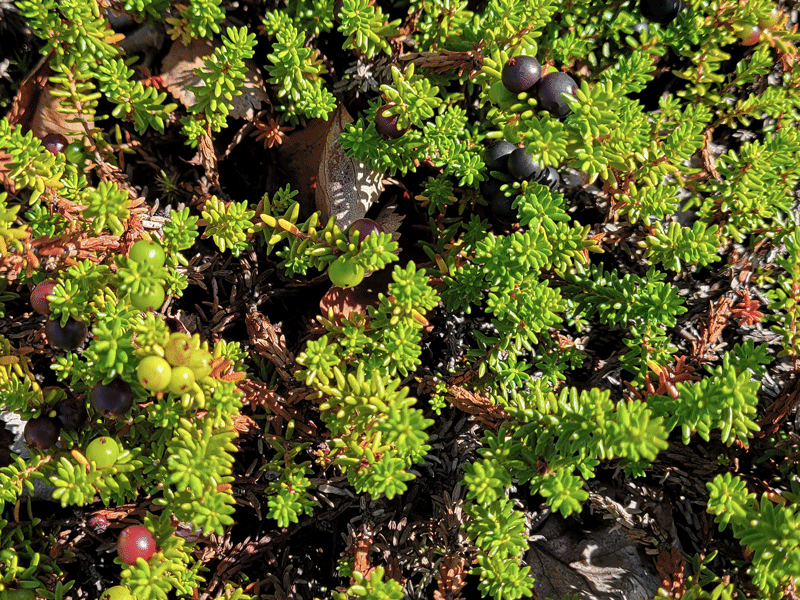

Low bush cranberries – also known as lingonberries in Sweden (delicious) 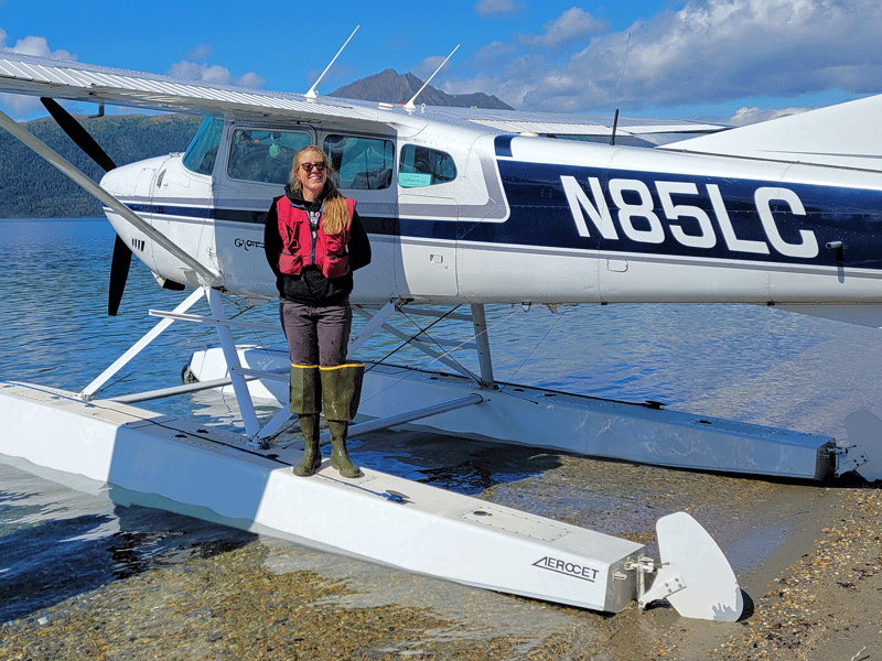
Danielle posing for the pesky tourists
After about a half hour exploring, it was time to head back to our home base in Coldfoot. Amazing places + a top notch pilot/tour guide = an unforgettable experience.
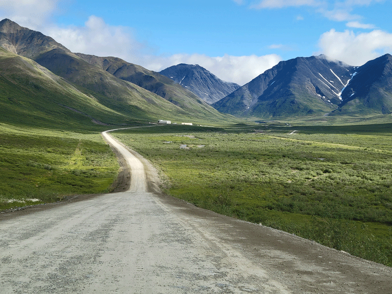
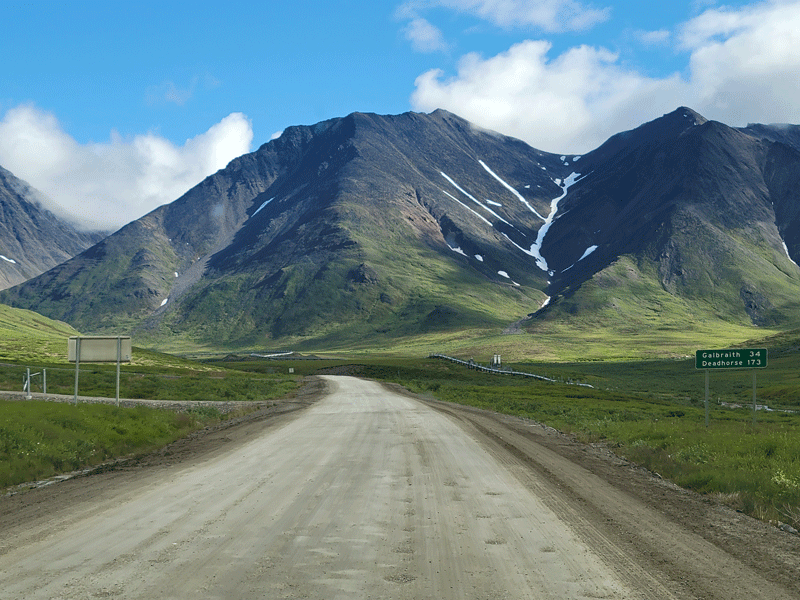
Day 3 – Brooks Range and Back to Fairbanks: A Different Perspective
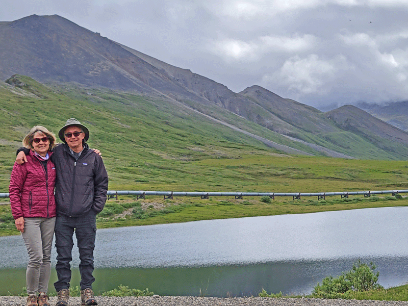
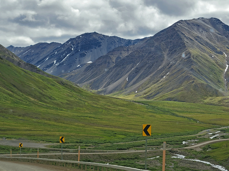
Another great day! We signed up for a van tour going north out of Coldfoot right through the heart of the Brooks Range and over the Continental Divide.
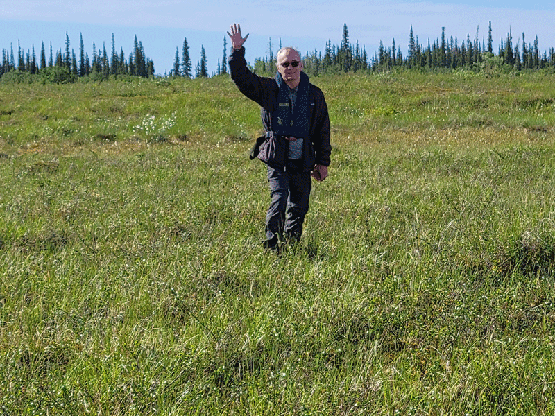
Meet Justin (pictured below), our driver and guide. Bill and I were the only guests on the tour that day, so we had his full attention (except for driving, of course). He patiently answered all of our many questions during the eight hour trip and allowed us some extra flexibility regarding the various stopping points along the route.
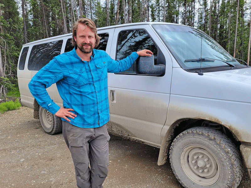
Justin loves spending time in this area – you can see it in his eyes and hear it in his voice. And he loves to share his knowledge and stories with people like us – first time visitors.
The trip map below was cobbled together from the BLM visitor guide to the Dalton Highway. Note that as you head north from Coldfoot, the highway threads the needle between Gates of the Arctic on the west and the Arctic National Wildlife Refuge on the east. Our turnaround point was at mile marker 275 for Galbraith Lake – exactly 100 miles from where we started.
Without further ado, let’s just dive into the photos.


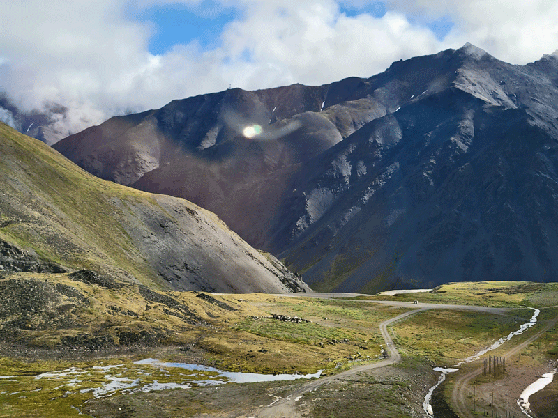

Water on the south side of the Continental Divide at Atigun Pass flows to the Bering Sea and Pacific Ocean. On the north side, water ends up in the Arctic Ocean. 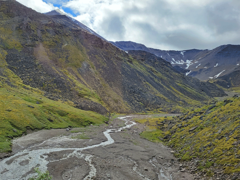


Wildflowers along the way – some familiar, others not.
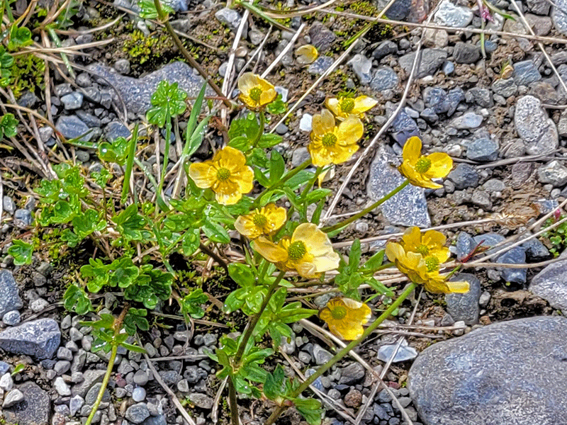
Buttercups 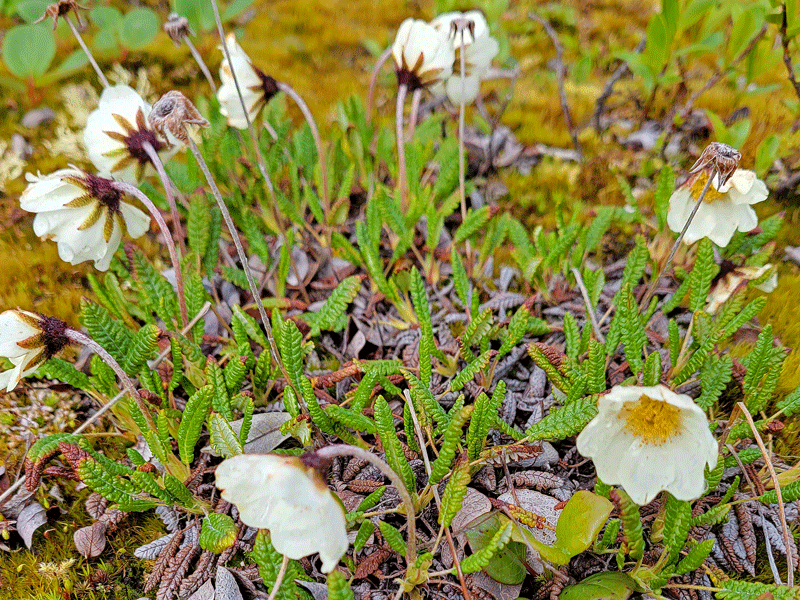
Mountain avens 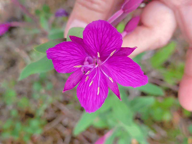
River beauty 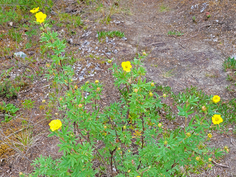
Tundra rose (known as potentilla where we live) 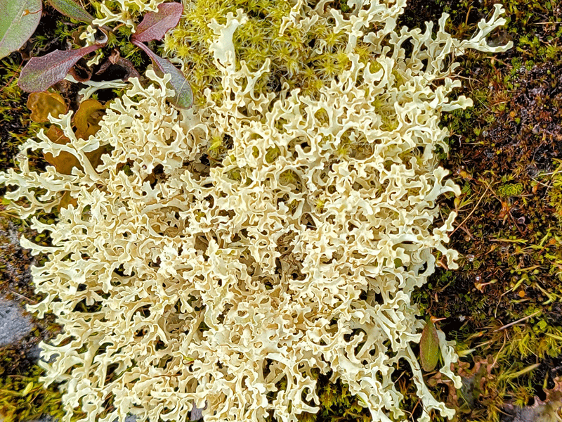
Lichens 
Cotton grass
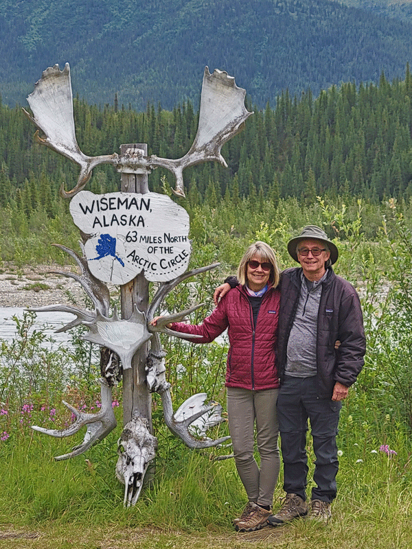
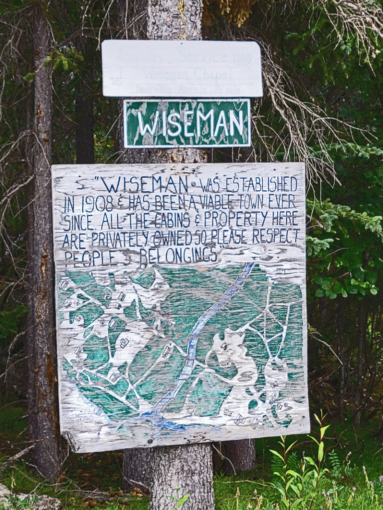
Fourteen miles before reaching Coldfoot on the return, we took a side trip to the town of Wiseman. Unlike Coldfoot, there are people who actually live in Wiseman – ten as of 2019. Entirely off the grid, and a full day’s drive to the nearest grocery store (one-way).

We stopped for a visit at the local museum, open only to tour groups 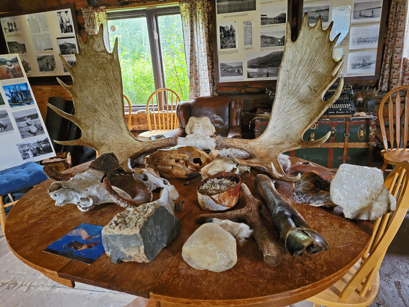
Inside the one-room museum 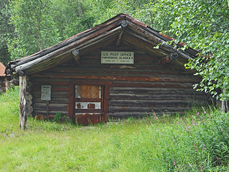
The old post office has been slowly sinking for the past century and now sits a couple of feet below ground level 
Could you live here? I couldn’t. Seriously, I would die in just a few weeks, likely due to starvation or exposure. Here’s an interesting article and video about a family who lives in Wiseman and loves it. It’s short and worth a click.
And that marks the end of our van tour through the Brooks Range on day 3. However, I’m not done telling you about Justin, our tour guide. He told us, “I’m a musician,” so of course we wanted to know more.
After spending the summer at his favorite place on earth, he will begin studying for his DMA degree this fall at the University of Washington. For those who may be unfamiliar, DMA stands for Doctor of Musical Arts – it’s the highest level of academic study for highly accomplished musicians. His areas of specialty are voice performance and composition, having earned his Master of Music degree from UCLA in May of this year.
He was a great tour guide, plus we enjoyed our conversations about his career aspirations and classical music. After returning home, we watched his MM recital on YouTube, which nicely showcases his diverse talents. So this is our plug for Justin’s website and his YouTube channel. And best of luck to him as he pursues his dreams!
Day 3 marked the end of our short time above the Arctic Circle, as we had a late afternoon flight back to Fairbanks.


A final look at the Yukon River
I’ll leave you with a few more photos from Coldfoot Camp. Our accommodations were rustic, and I don’t mean rustic chic. More like rustic dilapidated, but it was fine. Given our remote location, we were just glad to have a warm room and comfy bed to sleep in. The people were awesome, and the food was delicious. We would do it again in a heartbeat!
Here’s an aerial view of Coldfoot. I took the photo during our flight-seeing tour on day 2, then added labels to create a map of sorts. The on-site motel consists of a series of connected modular units that date back to the 1970s – still in use today with very few updates.


Main hallway in the motel 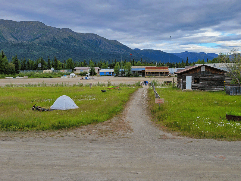
Looking from the motel to the restaurant – note the cyclist camping in the open space 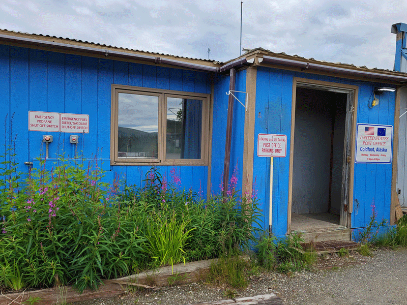
Post office is open for a few hours on MWF 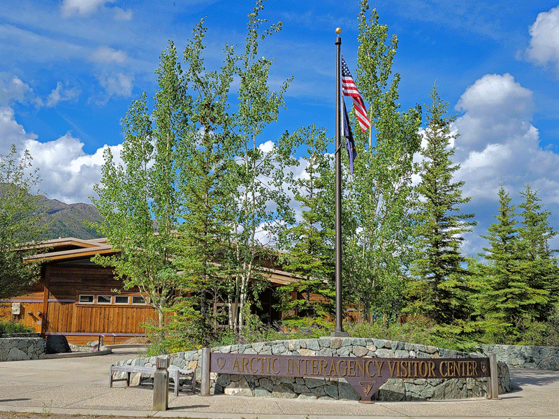
Super nice visitor center
Well, this article has gotten really long, so thanks for sticking with me. Many great memories from this excursion. I hope you enjoyed coming along for the ride!
Next post: Denali National Park
Discover more from Just Passing Through
Subscribe to get the latest posts sent to your email.


Just WOW!
LikeLike
Yup, that sums it up pretty well!
LikeLike
I had no idea it was so beautiful up there! Truly breathtaking pictures. Thank you so much for taking us with you! Loved it. xo
LikeLike
Hi Mary – thanks for taking a look. It was such a gift to be able to see it in person.
LikeLike
So… Did you have (the recommended) waders or gum boots when you stepped off the plane at Kobuk, “ankle-deep in soggy terrain” – (Note to self) ? So spectacular, so immense!
LikeLike
Well, not exactly . . . as in not at all, actually. But the waterproof hiking boots worked fine for the 20 minutes we were on the ground. What an experience!
LikeLike