“There are more things to do in Page, AZ than any other region in the entire state of Arizona.” (http://wedreamoftravel.com)
Wow – a lofty claim! And just to clarify, the fun things to do aren’t IN Page but AROUND Page, so you need transportation.
We enthusiastically agree that there’s much to like about the Page area. Here are the top 10 sight-seeing suggestions I found on an interesting travel site called http://walkmyworld.com. We did eight of them, plus I added a few more that we enjoyed. With apologies to the authors, I’ve rearranged the order a little to better tell the story of our visit.
#1 and #2: Antelope Canyon – Upper & Lower
This magnificent slot canyon was the original reason we went to Page, and it was worth every penny to tour both the upper and lower sections. Click here for the article and photos from our visit.
#3: Horseshoe Bend
Horseshoe Bend features a picturesque meander of the Colorado River, and it’s hugely popular with tourists. So popular, in fact, that finding an open slot in the parking lot can be a challenge, but we didn’t have a problem.
Located on the outskirts of town, it’s a short .75 mile walk to the Horseshoe Bend overlook, and we were pleased and a little surprised that visitors could venture outside the fenced area to explore other vantage points on their own. A fun place to wander around, but there’s not much to do except climb on the rocks and take photos from different angles.
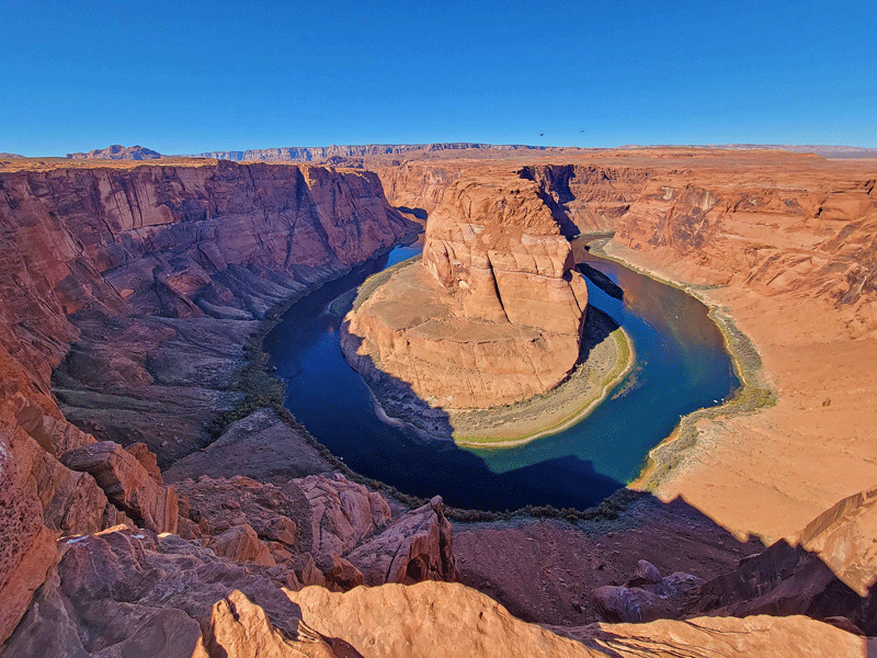
It’s a quick stop – definitely a must do!
#4: Lake Powell
There’s much that could be said about Lake Powell, but the short story is that this gigantic manmade reservoir on the Colorado River (second largest in the U.S.) is currently only 29% full, the lowest level ever. Reasons? Decades of increasing demand for water throughout the West plus high levels of evaporation during two decades of severe drought have simply outpaced replenishment inflows from rainfall and snowmelt.
The water level dropped 47 feet at Lake Powell in the past year alone and is projected to continue falling in 2022, even after receiving additional water allocations from upstream reservoirs.
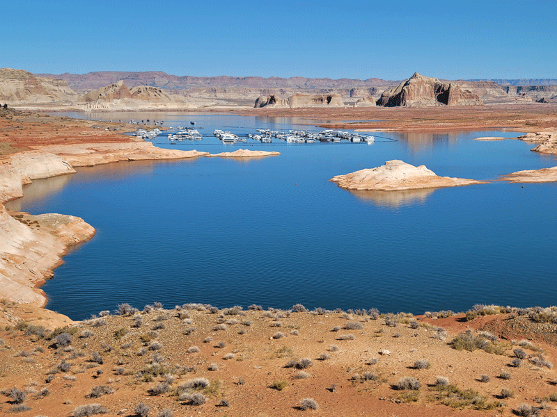
Not much water at Wahweap Marina (shown in the photo above) when we were there. Most boat ramps at Lake Powell were closed, and the whole area was eerily quiet. I bet you could find a good deal on a houseboat.
Boating activities on Lake Powell were severely curtailed in 2021 due to low water levels and essentially non-existent during our visit in October. The National Park Service reported a drop in recreational visits to Glen Canyon National Recreation Area from 4.3 million in 2019 to 2.5 million in 2020. And another big decrease in 2021 – just 1.4 million visits through August.
Limited water supply and decreasing recreational visits aren’t the only reasons to be concerned. Hydroelectric generators at the dam supply electricity to more than five million homes and businesses, and experts recently placed the odds of a shutdown in 2023 at 34%. Learn more by clicking here.
It’s a sad and scary situation.

#5: Wahweap Overlook
A bigger picture look at this section of shrinking Lake Powell and the Wahweap Marina.

#6: Glen Canyon Dam & Visitor Center
In the 1950s, the federal government decided to build a huge dam on the Colorado River in Glen Canyon for water storage and hydroelectric power generation. After making a deal with the Navajo Nation to acquire the necessary land, construction began in 1959.
Power was first generated in 1964, but it took 16 more years for Lake Powell to fill to capacity. When full, the reservoir is 560 feet deep at the dam, stretches 186 miles in length and covers 266 square miles.
At 710 feet, Glen Canyon Dam is the second highest dam in the U.S. after Hoover Dam, which is 16 feet taller.
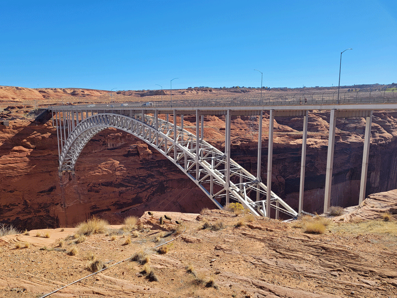
To visit the dam, cross the highway 89 bridge that spans the Colorado River. 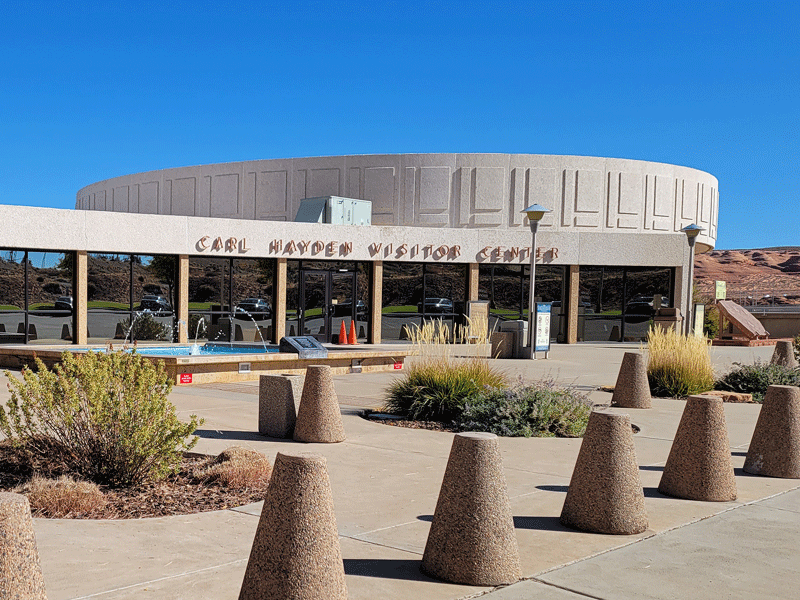
Stop at the visitor center just past the bridge. It was closed during our visit, but the parking lot was open. 
View of the dam from the visitor center overlook 
View of the Colorado River looking upstream from the dam 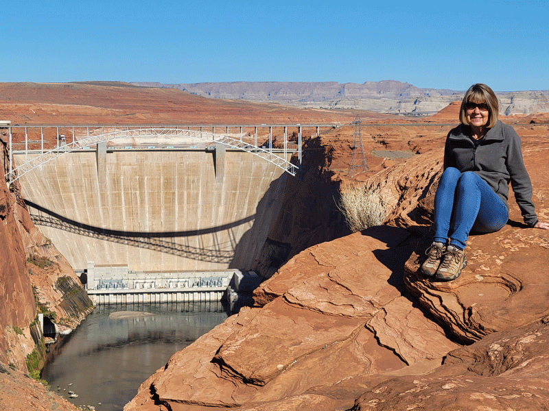
Back side view of the dam from overlook point on the Page side of the river 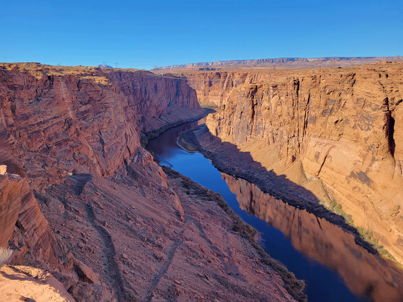
Colorado River looking downstream from the Page side viewpoint
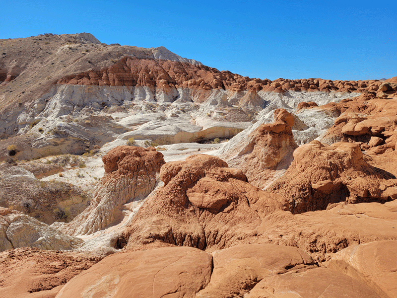
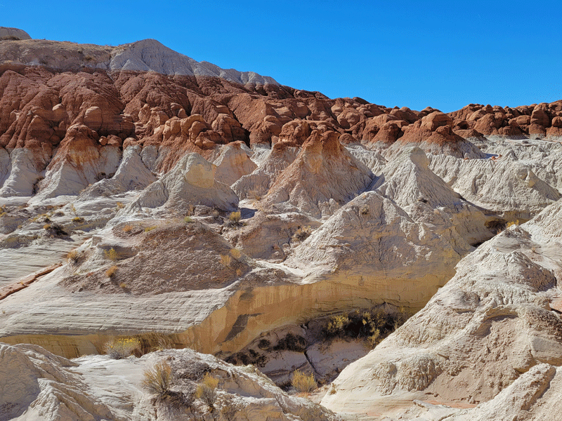
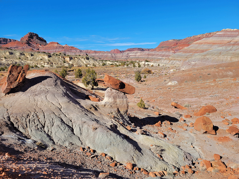
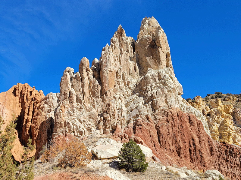
#7: Toadstools Hiking Trail
What’s the difference between a toadstool and a hoodoo? Nothing – just two different names for a rock formation that looks like a mushroom. It’s a boulder perched on a rock of smaller diameter.
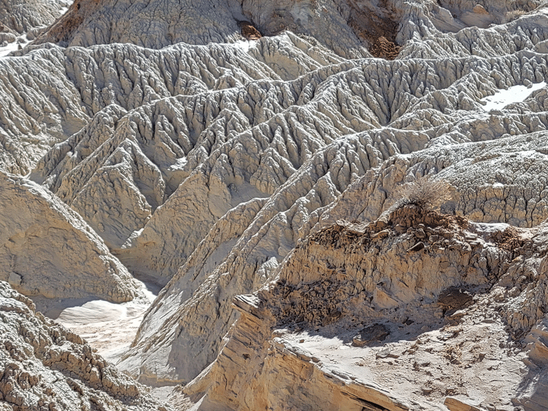
This excellent hike located close to the town of Page is in the Grand Staircase-Escalante National Monument, with interesting terrain on the way to the toadstools.
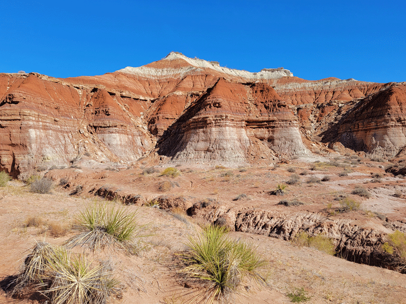
Upon arriving at the toadstools, the trail ends, and hikers are free to just explore.
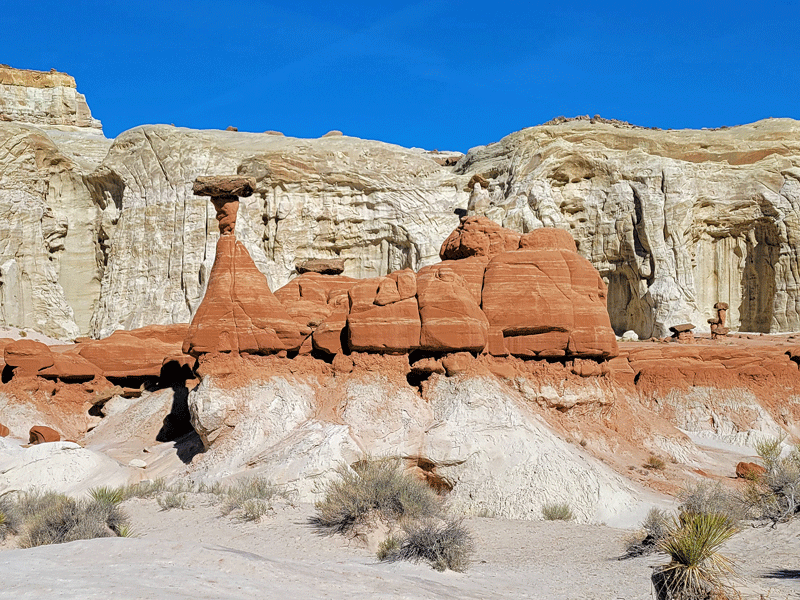
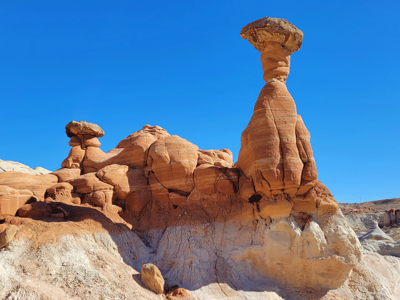

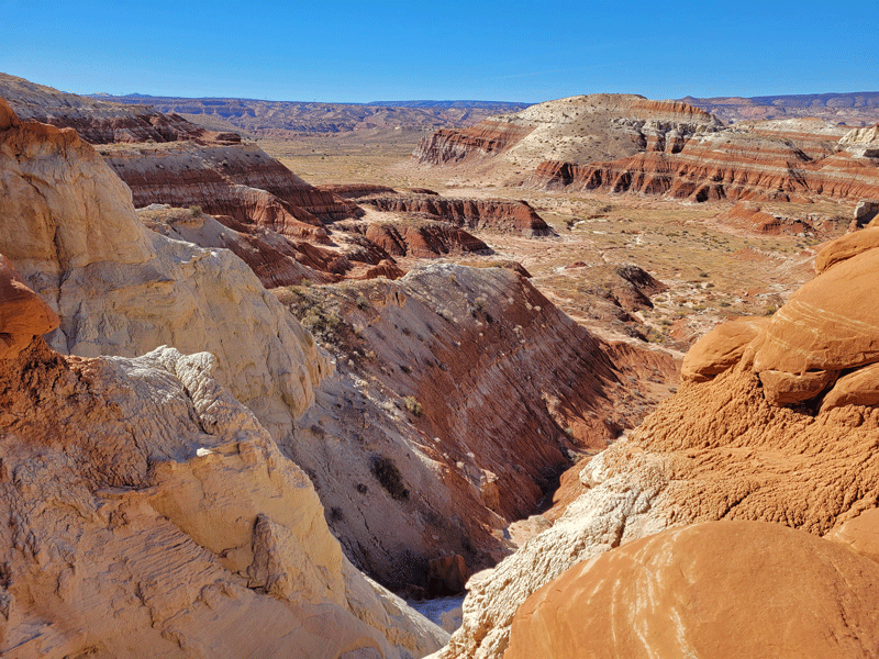

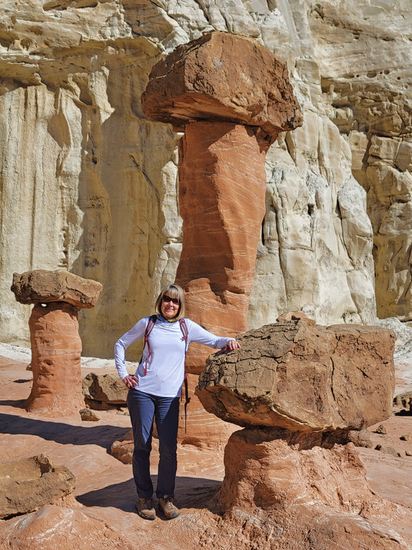
A fun little hike, especially in the fall when it’s not so blazing hot.
#8: Waterholes Canyon
We didn’t do a tour of Waterholes – it’s another slot canyon about ten miles from Antelope Canyon, apparently less crowded and (almost) just as fabulous.
#9: Hanging Gardens Hike
This short and popular hike didn’t make it onto our list of things to do.
#10: Monument Valley
Monument Valley would be a long day trip from Page. We opted to spend three nights there for a more leisurely visit, and it was excellent. Click here to read about our experiences (same article as Antelope Canyon).
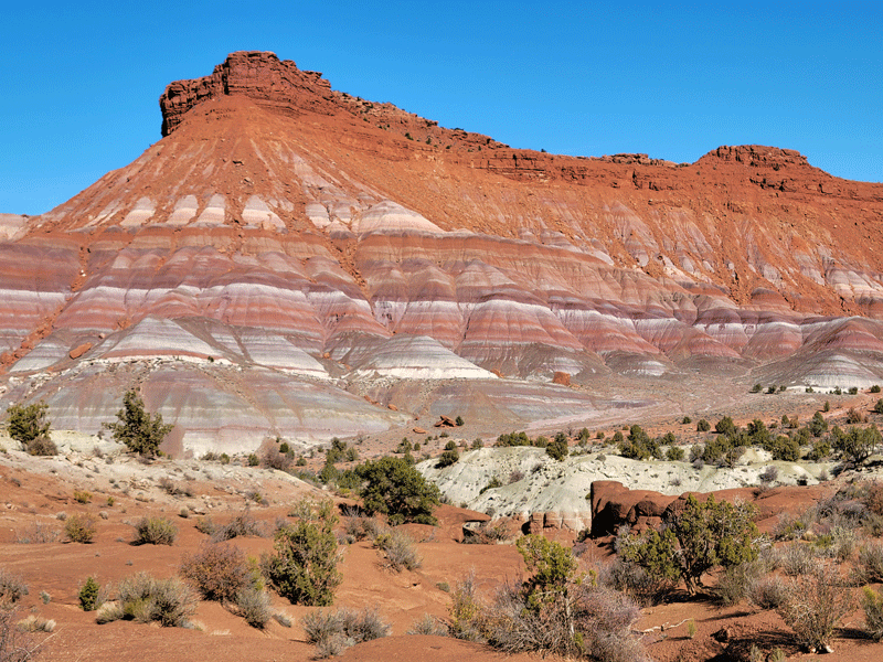
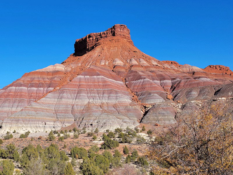
More Places to Visit – Northwest of Page
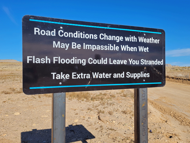
Driving north from Page on highway 89, you pass through the southern boundary of the Grand Staircase-Escalante National Monument. Including the Toadstools hike mentioned earlier, we spent the better part of three days exploring this area.


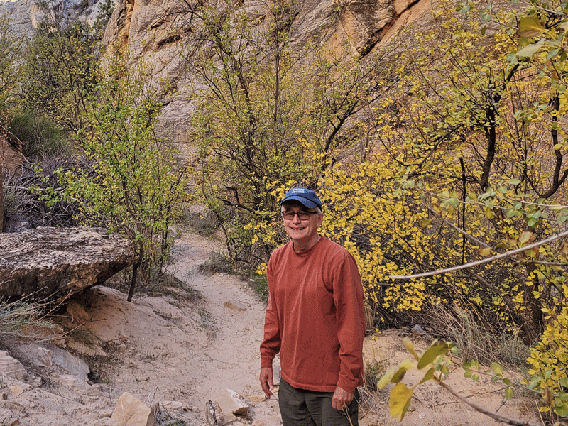
Paria Townsite
Paria is a ghost town. Founded in 1870 by Mormon settlers, it was home to 47 families at its peak, but frequent floods eventually drove them out. The last resident, a gold prospector, left in 1929.
Between 1943 and 1976, Paria was reincarnated as a popular location for film-making – most notably Sergeants 3 in 1961 and The Outlaw Josie Wales in 1976.
Today, you must look hard to find any physical evidence of Paria’s past, but the jaw-dropping natural beauty of the backdrop remains. Visitors can access the site from highway 89 via a five-mile dirt road that’s rocky, steep and narrow. It’s generally OK for 2WD vehicles as long as it’s dry. Our Subaru did great.
Very glad we made the trip – I’ve included a few photos of the landscape.


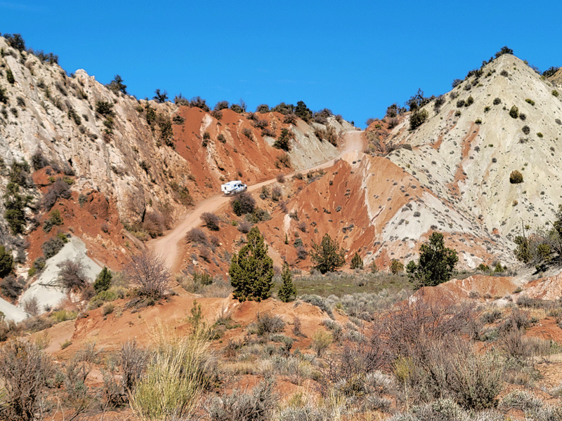
Cottonwood Canyon & Grosvenor Arch
Cottonwood Canyon is another dirt road in the Grand Staircase – frequently not navigable by 2WD vehicles, but the nice folks at the Big Water Visitor Center told us it had recently been graded and “should be fine.” We decided to give it a shot.
Our plan was to drive 30 miles up the road to Grosvenor Arch, enjoy a picnic lunch, then retrace our steps. Sixty miles on a bumpy and dusty – yet scenic – route.
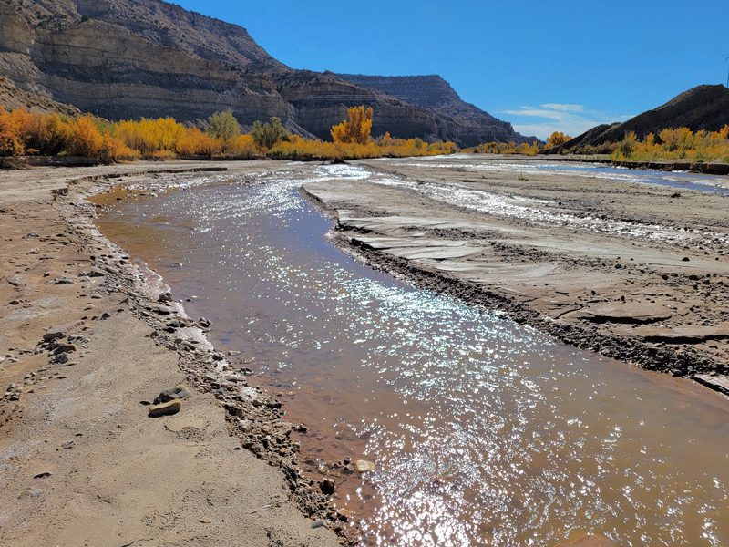
We found several places to stop and explore along the way, including the Paria River . . .
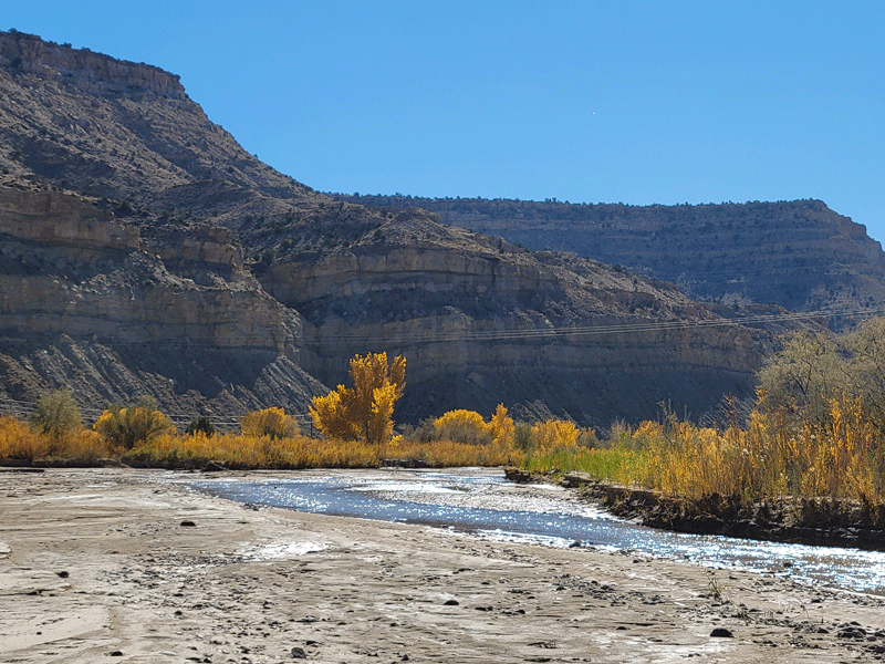
. . . and Cottonwood Narrows.

And just as planned, we had lunch, followed by a short walk around the area.


Backtracking on the return trip, we decided to stop and hike at Cottonwood Narrows.


It turned out to be a short walk. Advertised as a a 3-mile out and back hike through a beautiful narrow canyon, we only made it about half a mile before encountering a pile of huge boulders.

Possessing limited canyoneering skills (basically none), we couldn’t find a way to navigate past the rocks without risking a limb or two, so we gave up and turned around. Overall, however, it was a wonderful day trip.

More Places to Visit – Southwest of Page
We needed two day trips from Page to explore the sights southwest of town along highway 89A. Even if you don’t stop, it’s a beautiful scenic drive.
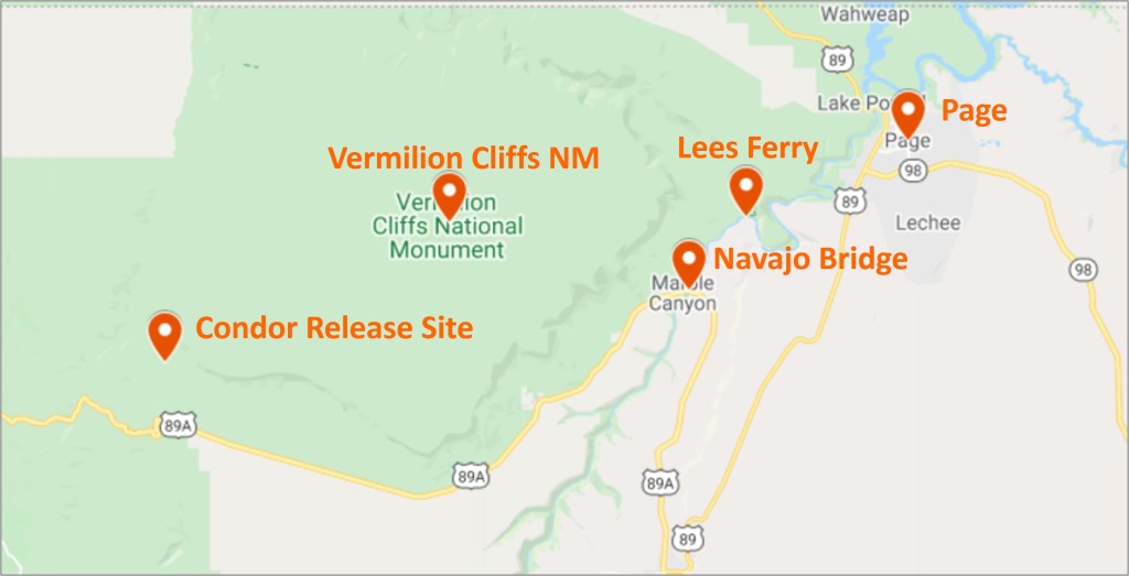
Historic Navajo Bridge
The first motor vehicle bridge across the Colorado River in this part of the U.S. opened in 1929 to great fanfare, including speeches, marching bands, choral groups, and according to the National Park Service, airplanes even flew under the bridge.
The historic bridge (shown on the left in the photo below) is now a pedestrian only walkway, and vehicles cross the river on the much wider and more modern bridge that was completed in 1995.
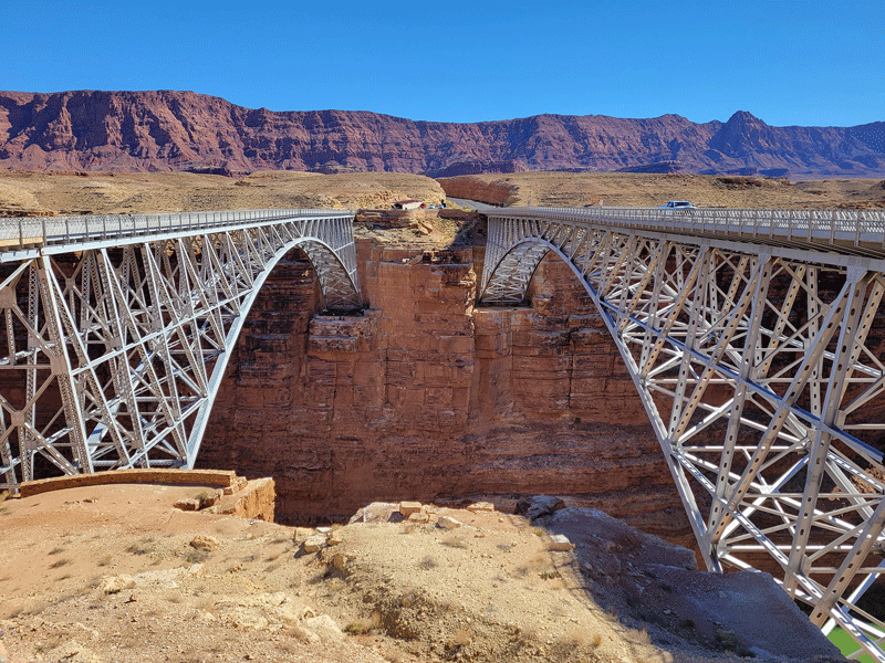
Parking areas are available on either side of the bridge, and there is a small historic interpretive center on the side where the photo above was taken. It’s worth a stop to walk across the bridge and view the exhibits.

Upstream view of Colorado River 
Downstream view of Colorado River
The biggest thrill for us was that five giant California condors were hanging out at the bridge within easy viewing distance. We had fun watching them for about half an hour – it’s amazing to watch them fly with their nine foot wingspans. No good photos, though – just black blobs.
It’s also worth noting that if you’re traveling from east to west toward Nevada, the next opportunity to cross the Colorado River by car is 300 driving miles downstream near Hoover Dam.
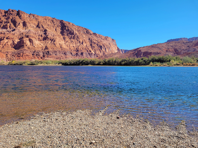
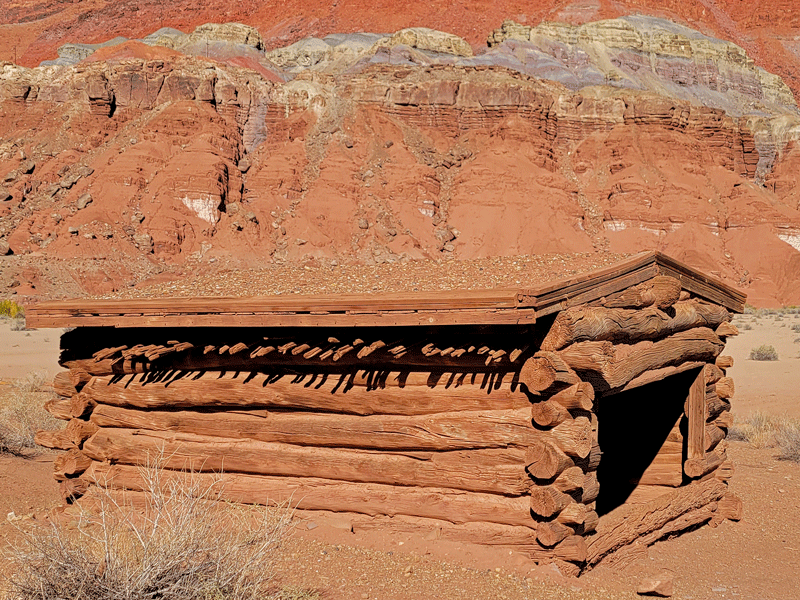
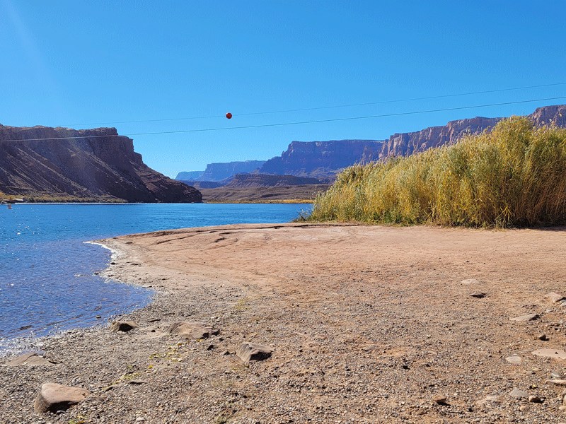
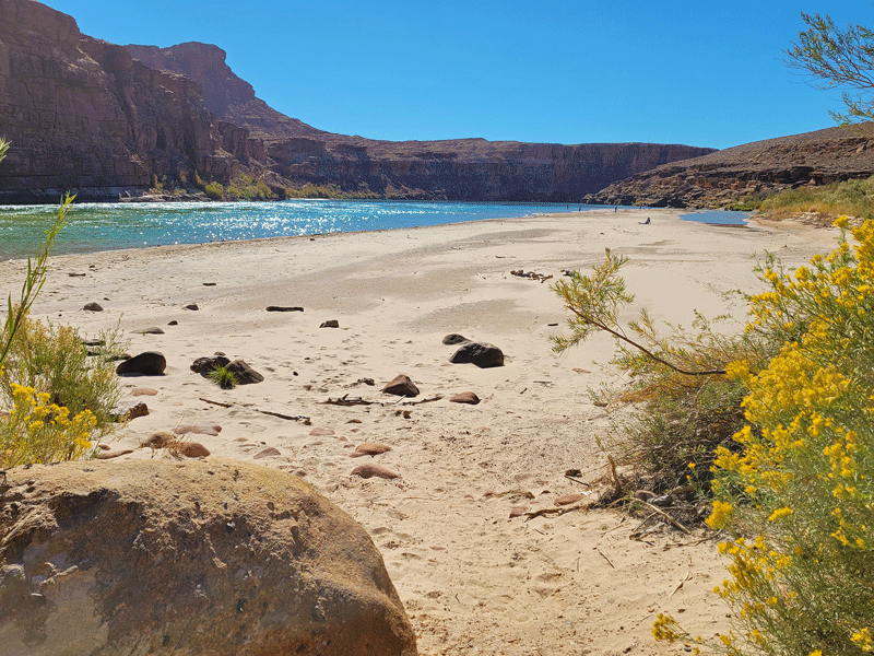
Lees Ferry
Lees Ferry, part of the Glen Canyon National Recreation Area, was the site of an actual ferry that operated between 1873 and 1928. And John D. Lee was the guy who started it. But there was a problem. Sixteen years earlier, he had taken part in the Mountain Meadows Massacre in which 120 people from Arkansas were brutally attacked and killed by a group of Mormons and Native Americans.
Mr. Lee was eventually found, arrested, convicted and executed for his role in the murders, so Emma, one of his wives, assumed operation of the ferry. It changed hands several times after that, until the single boat capsized just a few months prior to completion of the Navajo Bridge in 1929. The end of an era.
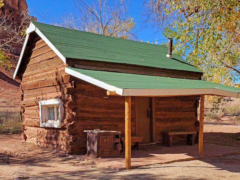
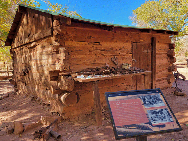
Visitors can take a walk around the historic Lonely Dell Ranch property, originally built for ferry operators and their families.
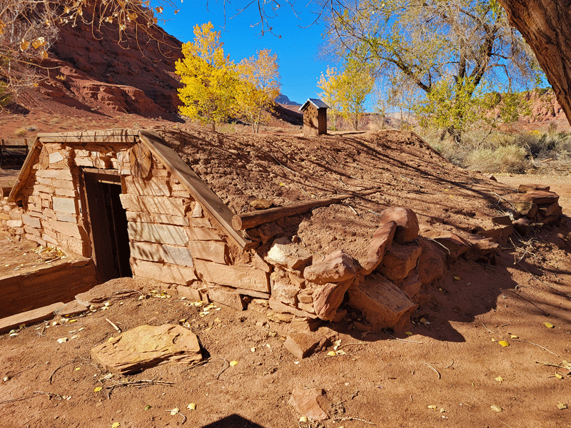
Root cellar 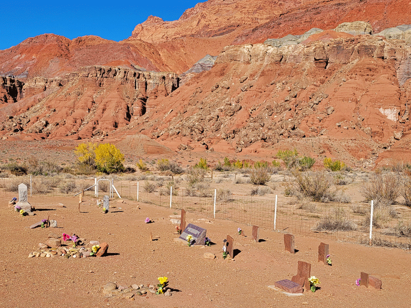
Pioneer cemetery 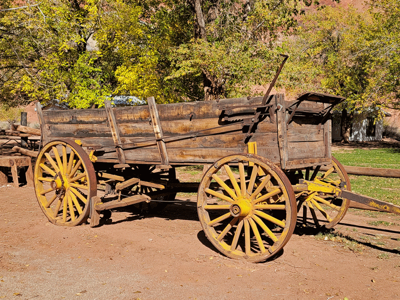
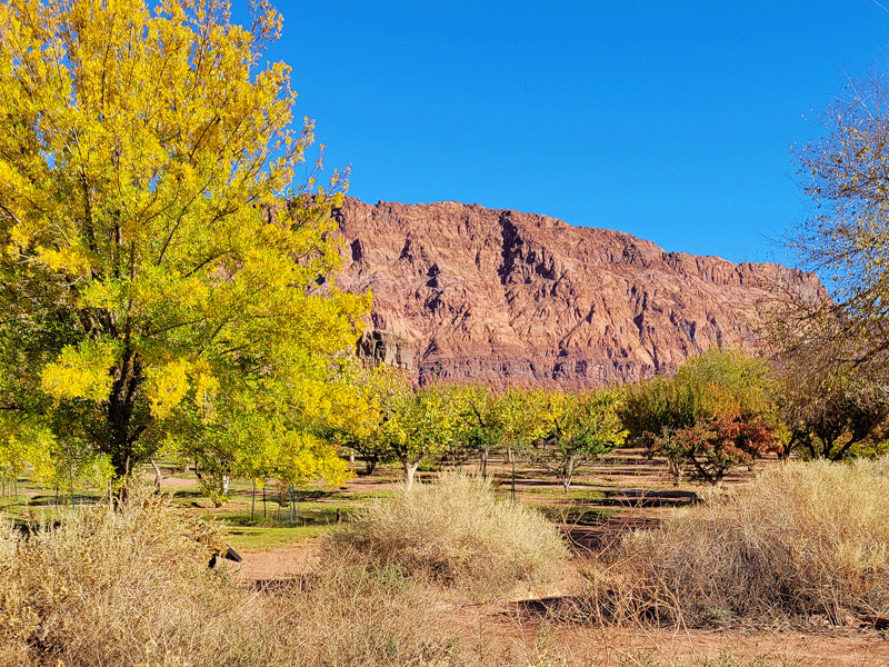
Orchard 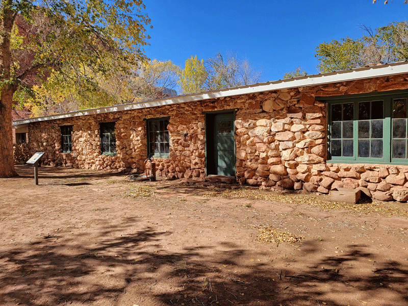
This lodge was built after the ferry years in hopes of attracting tourists 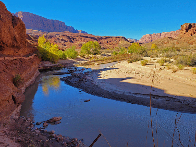
Paria River shortly before meeting up with the Colorado
Lees Ferry is best known today as the launch point for adrenalin-driven river rafters headed for the Grand Canyon. It looks so calm and peaceful here!
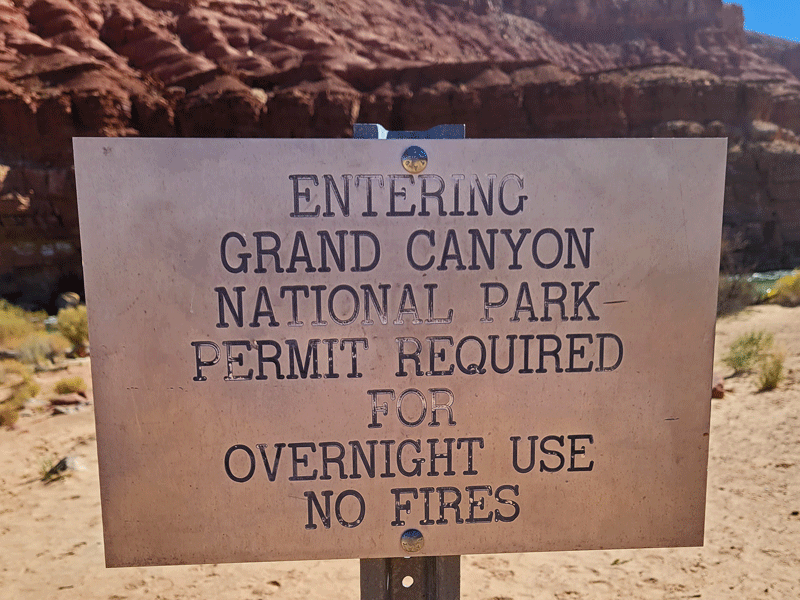
And speaking of the Grand Canyon, we were surprised to find ourselves walking into the national park at Lees Ferry. Cool!
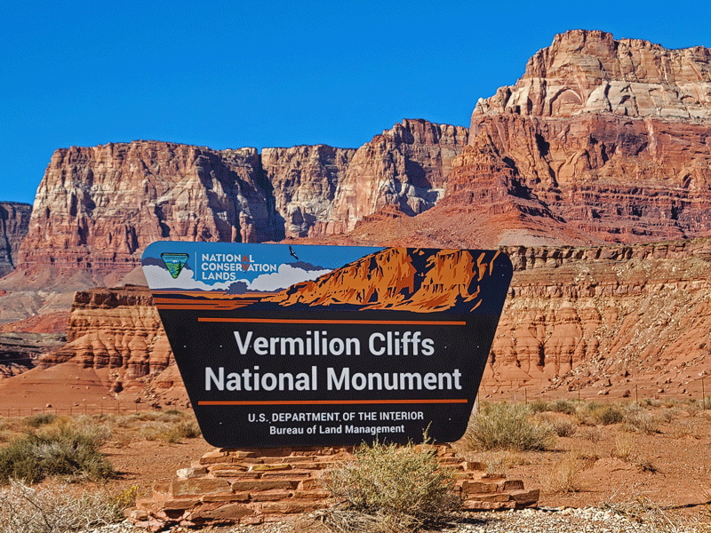
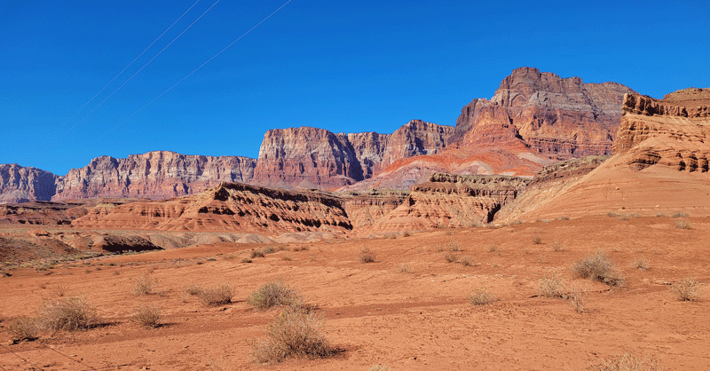
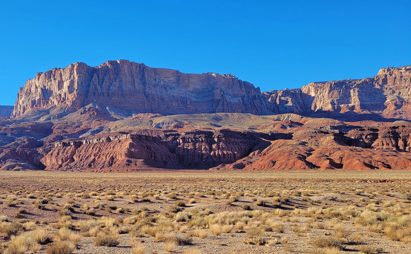
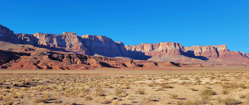
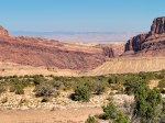
Vermilion Cliffs and California Condors
“Known for its colorful swirls of slickrock, Vermilion Cliffs National Monument is a sherbet-colored dream world filled with fantastical rock formations . . . .” (http://grandcanyontrust.org)
This protected area is not designed for casual visitors like us. Most roads in the Vermilion Cliffs are 4WD only, and most hiking trails require a permit, which are few in number and available only through a lottery system.
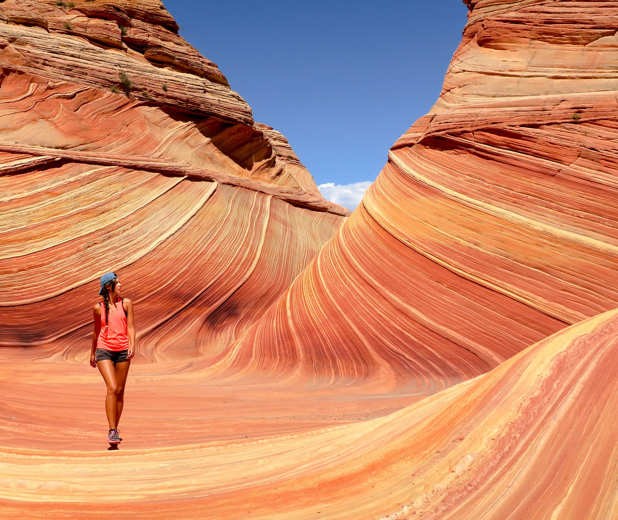
The most famous hiking trail is “The Wave,” and we weren’t able to snag a coveted permission slip. Here’s a glimpse of what we missed.
But there are nice views from the highway and numerous pullouts to stop for photos.


Now more about those California condors, which were on the brink of extinction in 1982. The primary culprit was lead poisoning, ingested from spent ammunition in carrion. Thanks to captive breeding programs and hunters’ willingness to switch to alternative types of ammo, the free-flying population in California and Arizona now numbers over 300. But much work remains to ensure that this important scavenger species continues to exist.
The Peregrine Fund, in partnership with the Bureau of Land Management (BLM), started a condor release program at Vermilion Cliffs in 1996, and there are now about 80 free-flying birds in the area.
With a wingspan approaching 10 feet, condors are the largest flying birds in North America.
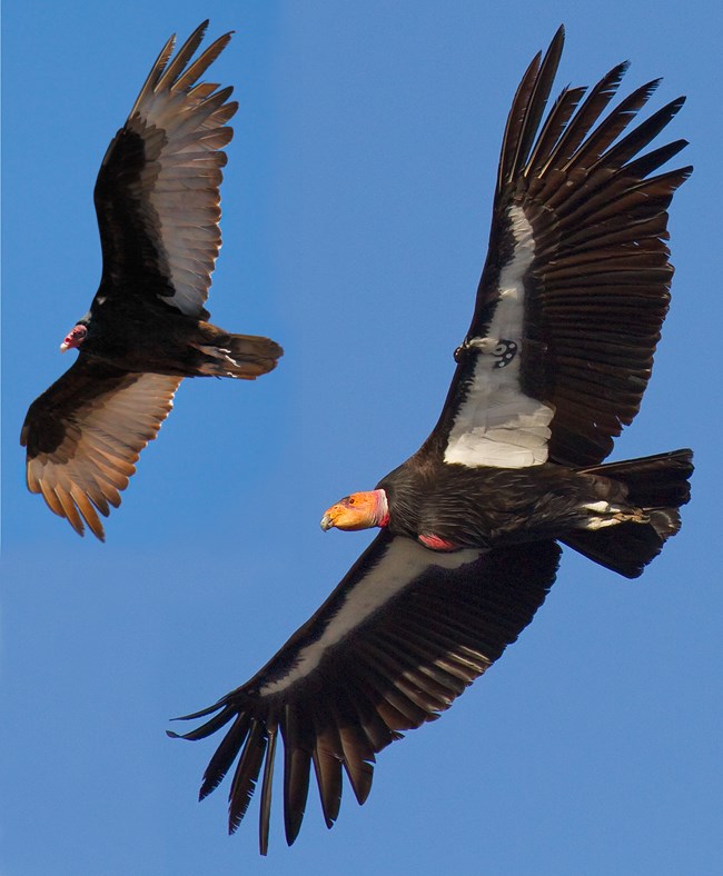
We stopped by to see what we could see. The term “viewing site” is an ambitious description. The cliffs are so far away that even with binoculars, you’re not likely to see any birds.

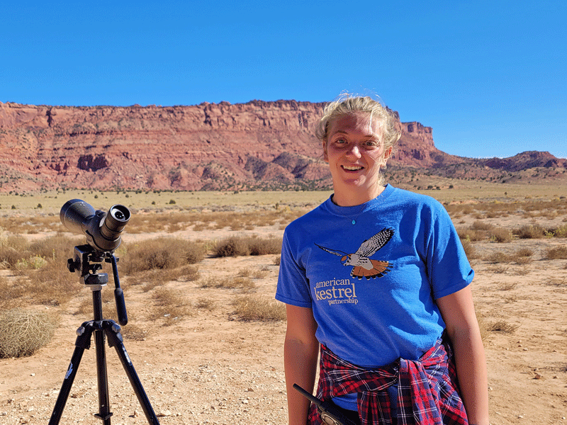
Luckily for us, a field biologist with the Peregrine Fund was doing onsite monitoring that day. She was happy to answer questions, and most importantly, shared her spotting scope with us.
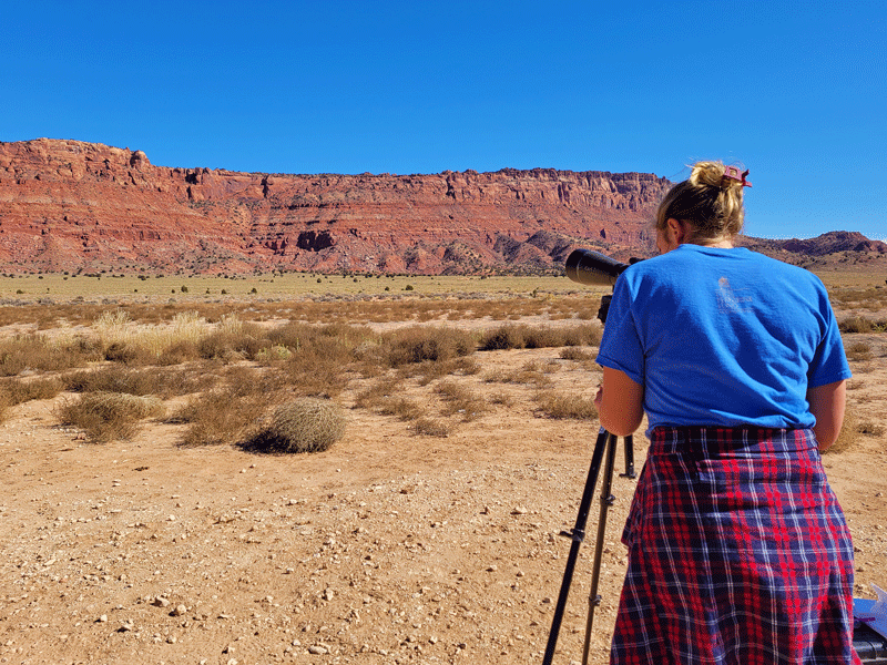
Several giant birds were readily visible as they soared at the edge of the cliffs. It turned out to be a worthwhile excursion.
And then our days in Page came to an end. It was a good place to park ourselves for a week while we explored the sights. Just know that the town itself (population 7,500) offers all the travel necessities – lodging, food and fuel (even a flu shot for me!) – but is short on charm. Page isn’t a cute tourist town with a quaint downtown, interesting shops featuring local artists, and trendy but overpriced restaurants. There isn’t even a local history museum, because, well, the town itself didn’t exist until 1957. It was created to house workers during construction of the dam. Nothing more, nothing less. But it gets the job done.
Next stop for us on our tour of the Colorado Plateau – Kanab, Utah.
Discover more from Just Passing Through
Subscribe to get the latest posts sent to your email.


Oooooh! You saw the big birds! Most exciting. I loved the Vermillion Cliffs and driven to return for a missed walk or two in that area. Great Blog Post! Made me feel it again.
LikeLike
Thank you, Marlene! It’s such an amazing area – we loved it.
LikeLike