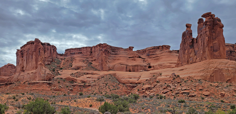
Moab, Utah: population 5,300. Annual visitors to Moab: 3 million. All looking for a memorable experience that includes food, lodging and fun. And all trying to get from point A to point B by driving the one street that runs all the way through town.
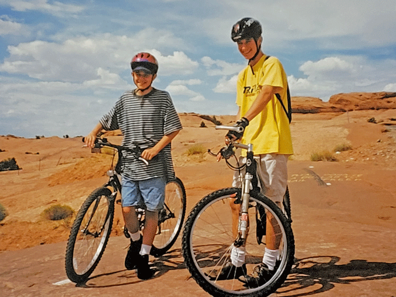
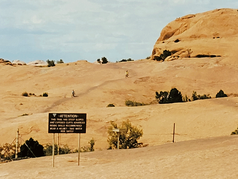
Our first visit to Moab was in 1996, when it was a sleepy little town with a growing reputation for mountain biking. Which is why we were there – here’s an old photo of our boys at the start of the “must do” Slickrock Trail.
Today, Moab is still a mecca for mountain bikers, but also the main hub for visitors to two nearby national parks – Arches and Canyonlands, as well as a long list of other outdoor pursuits. Demand for Arches is so high that just gaining entry to the park requires flexibility and a heavy dose of patience. From the NPS website:

I’m happy to report that we were successful!
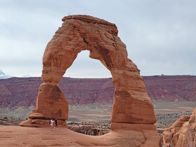
We arrived early on a Thursday morning, and after a 40-minute wait at the entrance station, we were in! Number one on our “to do” list was the Delicate Arch hike, so we headed straight to the trailhead and only had to circle the parking lot once before snagging a spot. Then we queued up for another 15 minutes to use the restrooms before embarking on the 3 mile hike (roundtrip) alongside dozens of others who had the same idea.
A few more photos from the Delicate Arch hike:
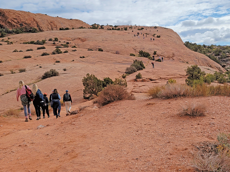
Trail heads up a huge expanse of slickrock – notice the human dots up the way 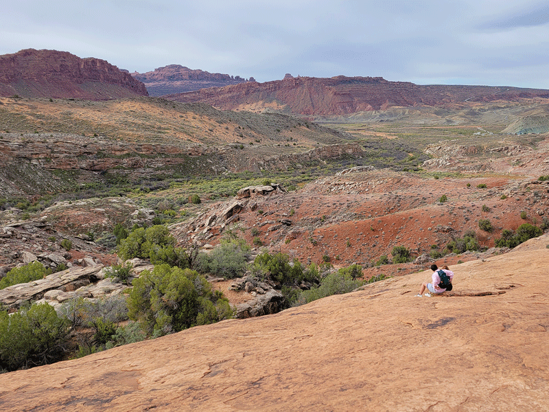
Valley view 
At the arch – view in one direction . . . 
. . . And the other direction 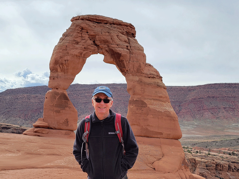
The opening for Delicate Arch is 46′ wide and 32′ high

Old cabin along the trail 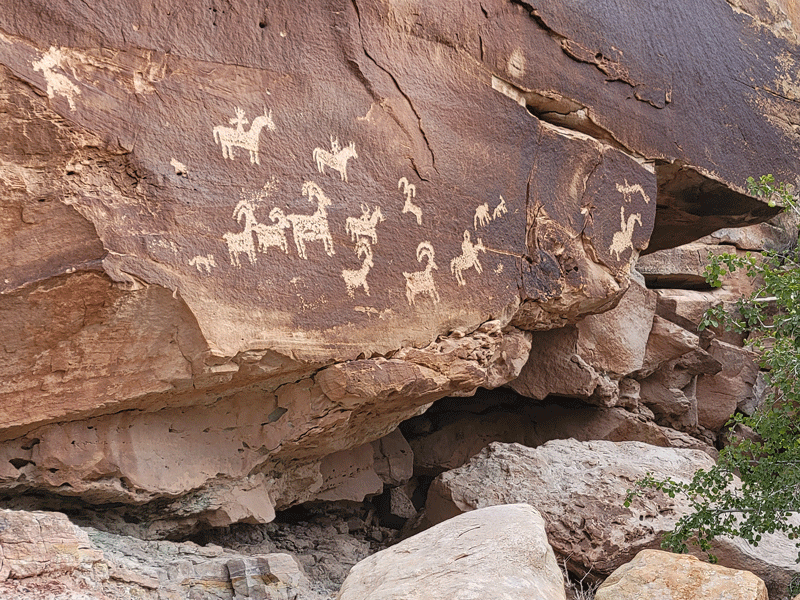
Petroglyphs along the trail 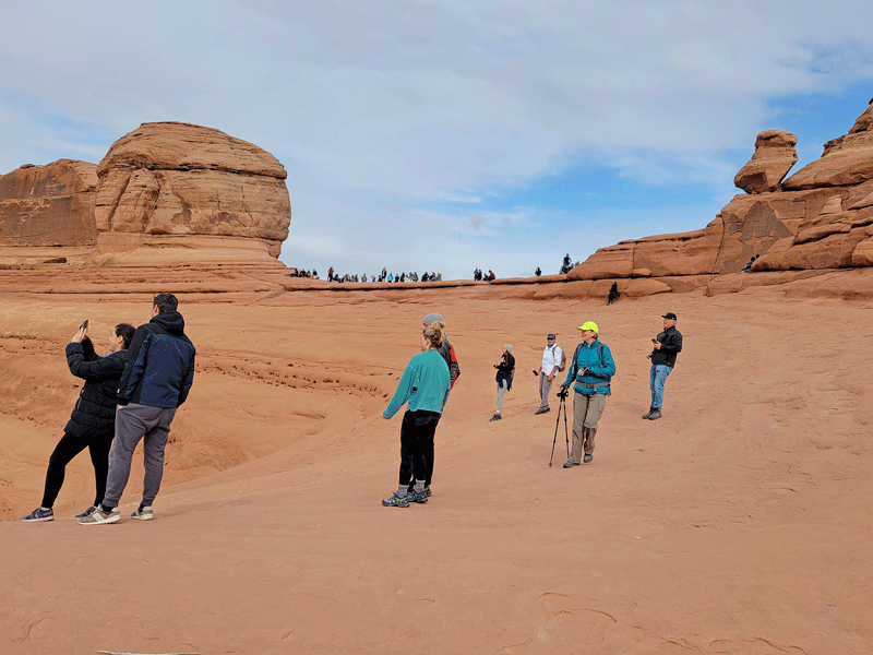
Fellow visitors at the Arch
After completing the Delicate Arch hike, we continued on to check out a few more of the 2,000 arches located within the park boundaries.

Skyline Arch 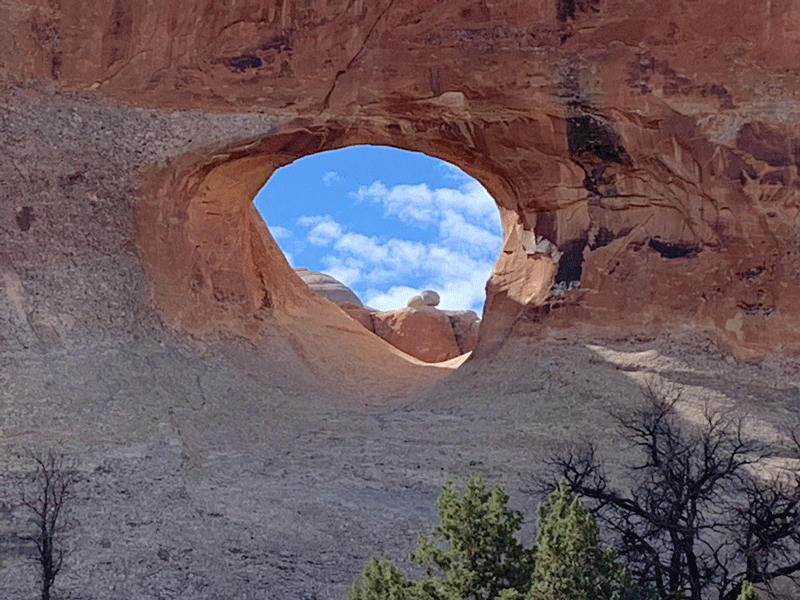
Tunnel Arch 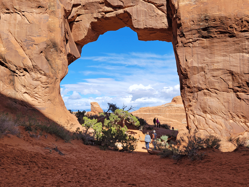
Pine Tree Arch 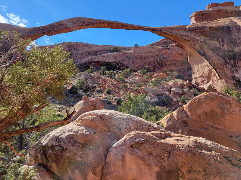
Landscape Arch opening is 306′ wide and only 11′ thick at its thinnest point
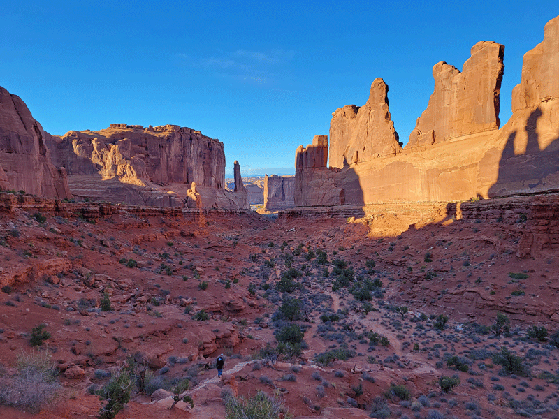
Worth the hassle? Heck, yeah, so I returned solo for a second round, with only a 20 minute wait at the entrance station in mid-afternoon, but finding parking was a challenge. More arches:
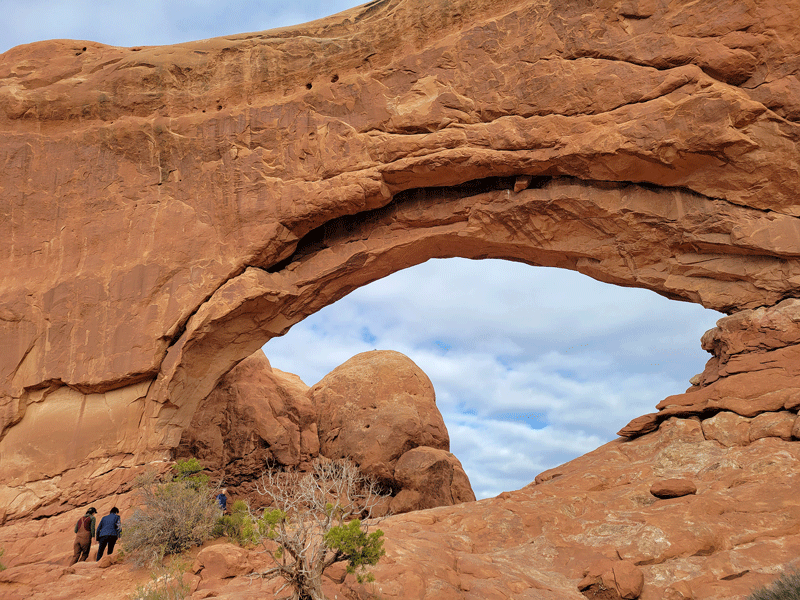
North Window 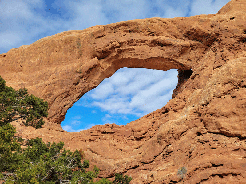
South Window 
North & South Windows front side . . . 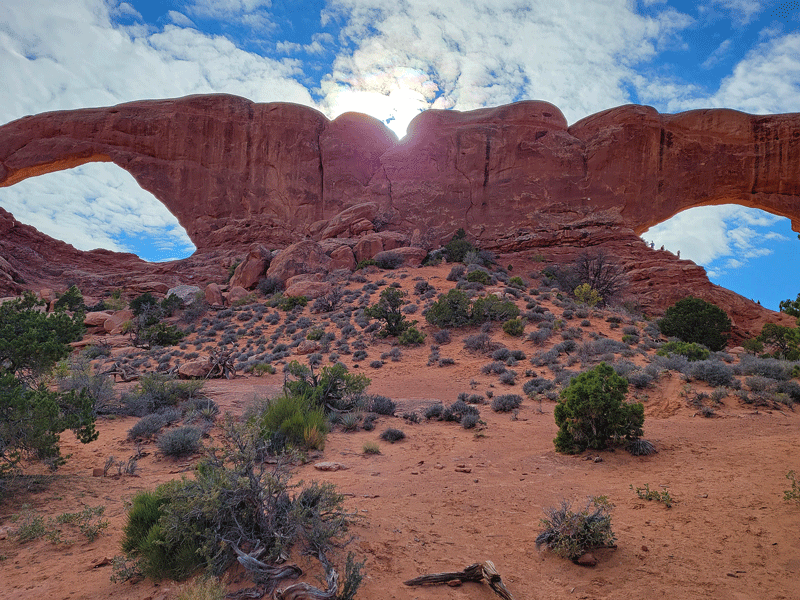
. . . and back 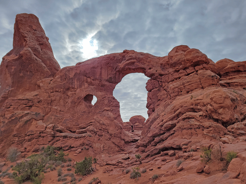
Turret Arch 
Double Arch – my favorite of the day
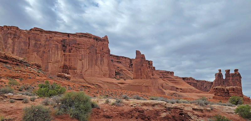
Plus more than a few other interesting rock formations.
Crowds aside, Arches is an amazing place! But innovative solutions by the National Park Service to provide a better guest experience are long overdue. Timed entry reservations? Shuttle buses? Prepayment of park entrance fees? All of the above?
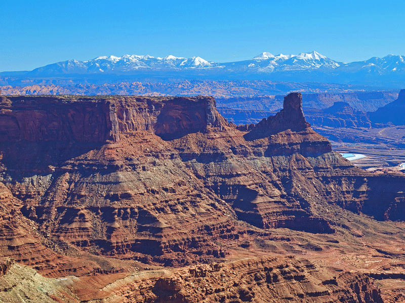
Canyonlands National Park
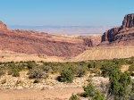
Canyonlands National Park encompasses 527 square miles centered around the confluence of the Colorado and Green Rivers that divides the park into three districts.
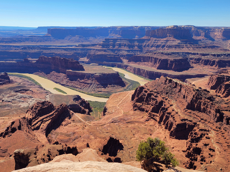
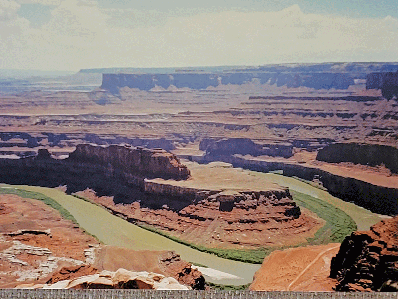
Island in the Sky is a large mesa with overlooks to the White Rim sandstone bench 1,200 feet below the surface, then to the rivers another 1,000 feet down. This section of the park attracts the most visitors, and for good reason – stunning views!
Here are my 10 favorite photos from our visit to Island in the Sky:

Shafer Canyon 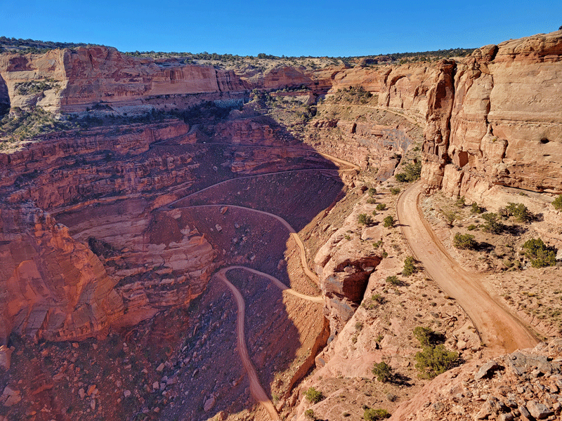
Shafer Trail 
Mesa Arch 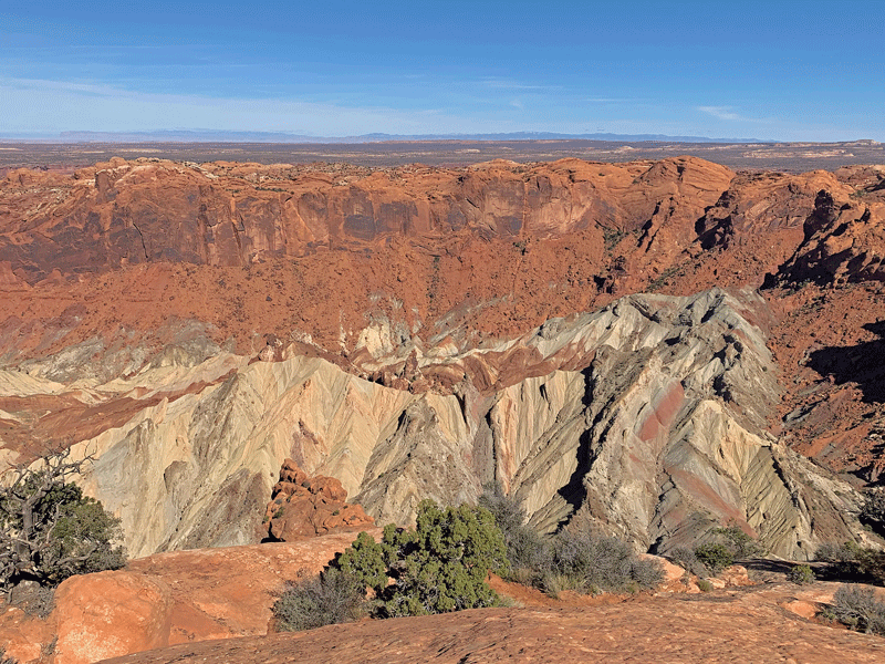
Upheaval Dome 
Green River Overlook 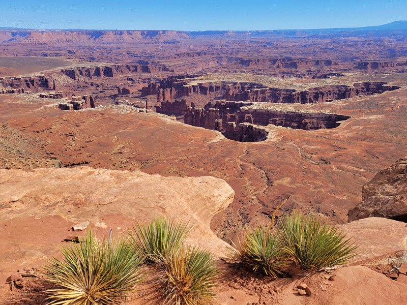
Along the trail to Grand View Point 
Also on the trail to Grand View Point 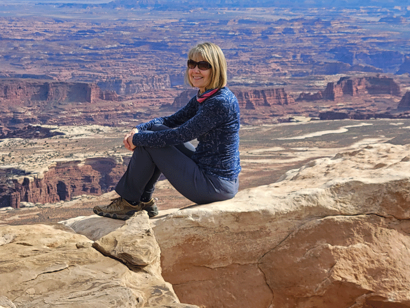
Grand View Point 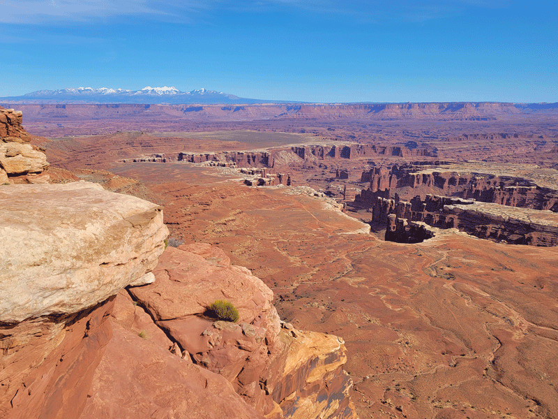
Grand View Point 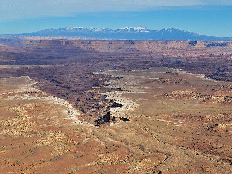
White Rim Overlook
And a bonus:
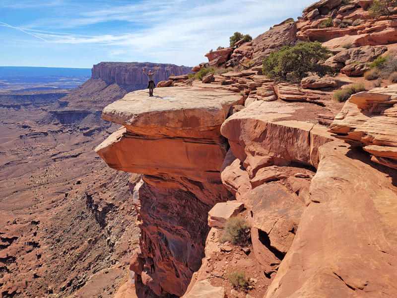
Who’s the guy on the rock? 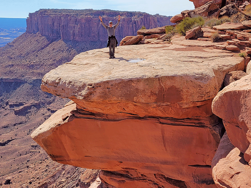
Why, it’s Bill!
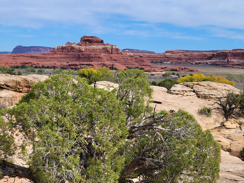
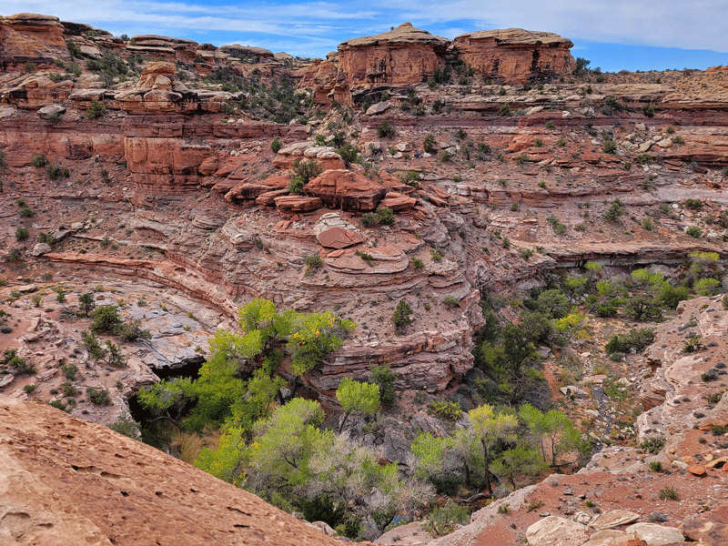
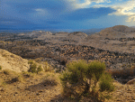
The Needles district draws the second highest number of visitors and features altogether different scenery – rock pinnacles with red and white bands of sandstone, along with other weird and cool rock formations that led us, more than once, to wonder how it happened.
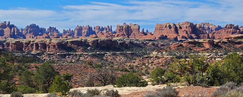
“The Needles” rock formations 
Snow on the La Sal mountain peaks 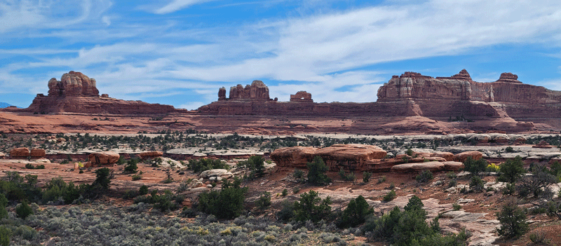
Hints of fall color 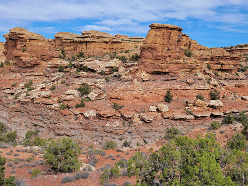

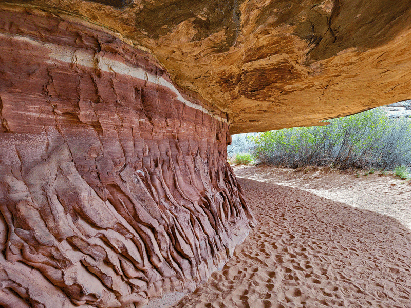
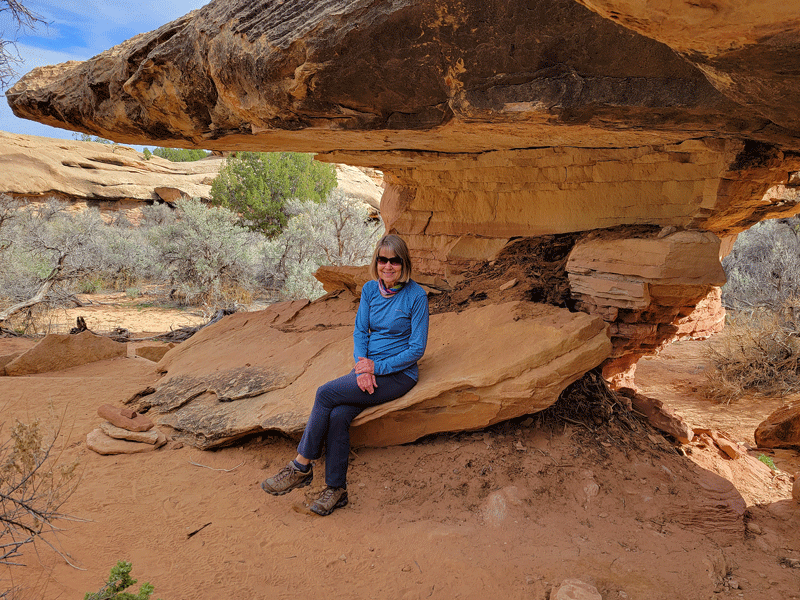
Interesting rock overhang on a hiking trail 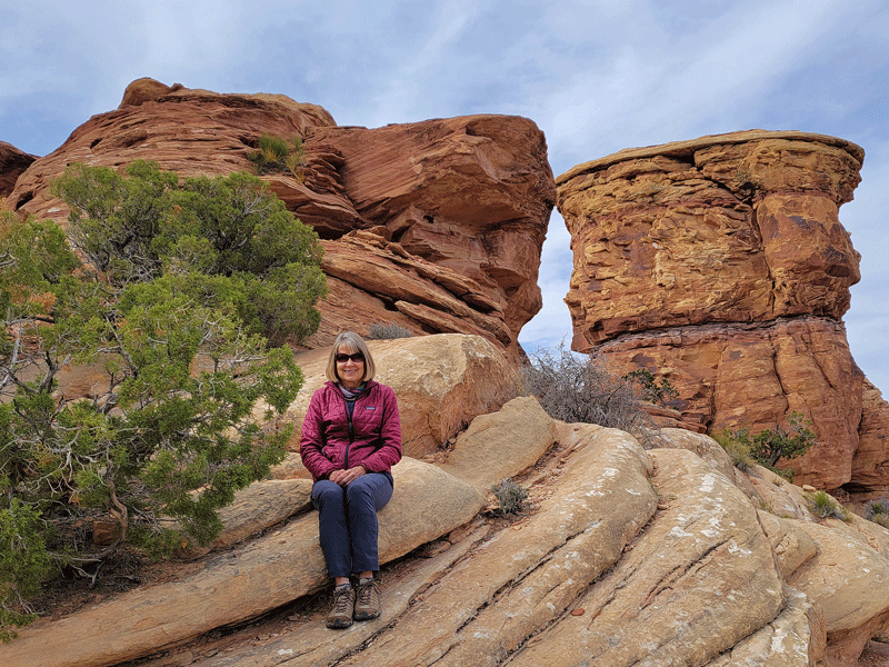

Ladder on the trail
Although the two areas are separated only by a river, it takes two hours to drive the 107 miles from one to the other!

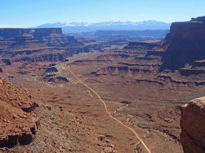
Dead Horse Point State Park
My favorite memory from the 1996 family vacation in Moab was our visit to Dead Horse Point State Park. I don’t recall why we decided to check it out – perhaps from the description in the Moab visitor guide. We made the 45 minute drive from Moab on a day with temperatures in the 90s and decided to hike to Dead Horse Point. (Pretty sure the teenagers weren’t too keen on the idea.)
Why is it called Dead Horse Point? According to one legend, cowboys corralled wild horses onto the Point, and after taking the best of the bunch for their personal use, left the others trapped, and they succumbed to thirst and the elements. If true, it’s a gruesome story.
So what draws 1.2 million visitors to this relatively small state park (5,300 acres) each year? Located 2,000 feet above a gooseneck in the Colorado River, the sandstone canyon views from above are amazing.
Twenty-five years ago, Dead Horse Point was a very different experience. As I recall (accuracy not guaranteed), the park was largely undeveloped – just the road to get there, the entrance station, a parking lot, and a hiking trail to the Point. No amenities, no mountain bike trails, no campgrounds, no visitor center, no paved road to the Point, and certainly no crowds.
Back then, the four of us hiked to the Point under the hot sun, and when we arrived, it was a magical moment – looking over the edge and experiencing the expansive view and pervasive silence. Just us – no other people around.
Well, this visit had no magical moments. The view is still special, of course, but everything else has changed. You can now drive to Dead Horse Point on a paved road, hop out of your car, walk along the canyon rim on a paved path with dozens of other chattering tourists, snap a few photos and be on your way to the next attraction within a matter of minutes. Not exactly conducive for quietly communing with nature.
At least we didn’t drive to the Point – we hiked along the canyon rim on the east side from the visitor center and back on the west side. Here are a few photo highlights.
La Sal Mountains in the background – crystal clear on a cool, autumn day 
A partial view of the Colorado River as it meanders through the canyon 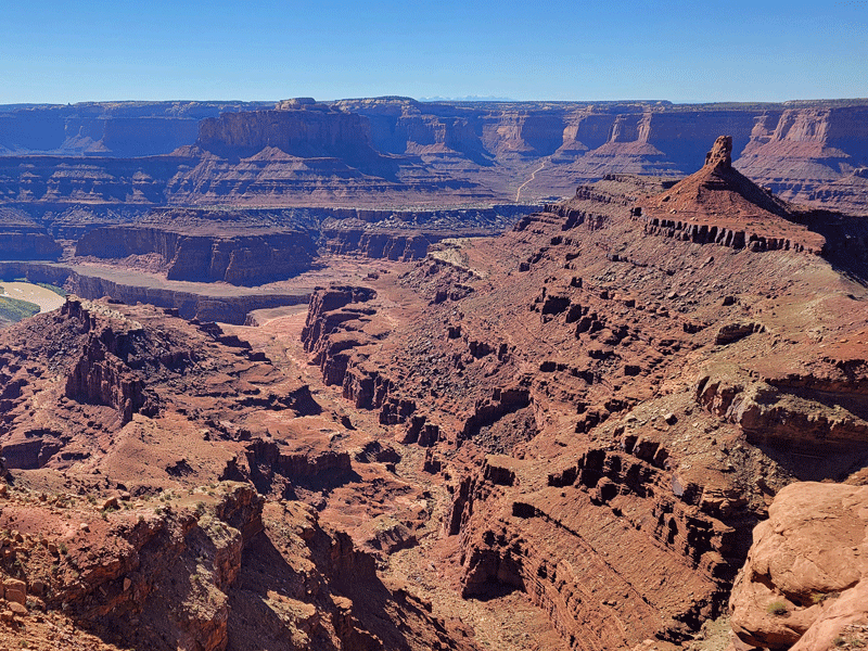
View of Shafer Canyon, with a portion of the 20-mile Shafer Trail visible in the distance
Even though the overall experience didn’t live up to my (unrealistic?) expectations, it was still a good day, and I’m glad we went.
Corona Arch Hike
Located just outside Arches National Park, Corona Arch is a gem. The easily accessed trailhead along the Colorado River is a lovely starting point for the 3-mile round trip hike that is challenging enough to make you pay attention, including a couple of sections with chains, as well as a short ladder climb and a fair amount of “butt” scrambling on slickrock for me. Nonetheless, we saw plenty of dogs and young children successfully navigating the obstacles, so we forged ahead.
The payoff at the end was worth the effort, with not one, but two beautiful and very different arches. Corona Arch is an impressive 140 feet across and 105 feet high.
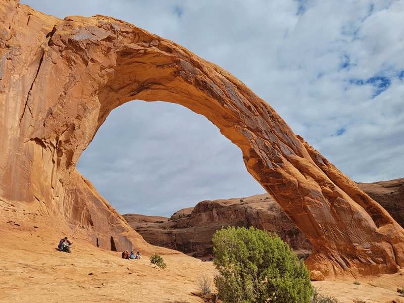
A couple hundred yards away is Bowtie Arch, much smaller but equally amazing because of its unique structure.

Photos along the hiking trail:
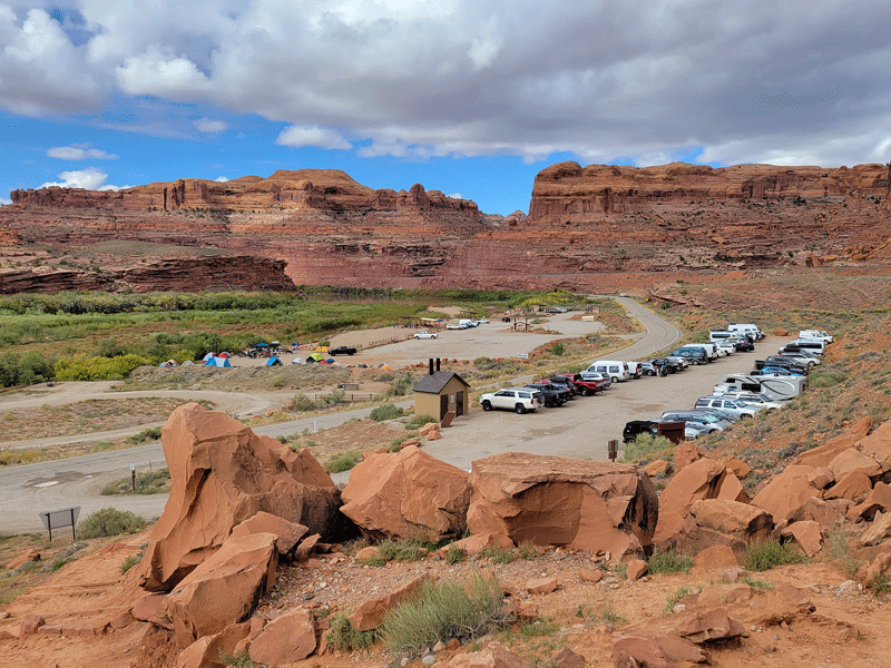
Parking at Corona Arch trailhead 
Colorado River view from the trailhead 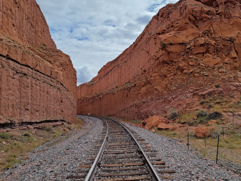
Hiking trail crosses inactive railroad tracks 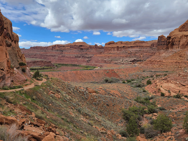
Interesting rock forms 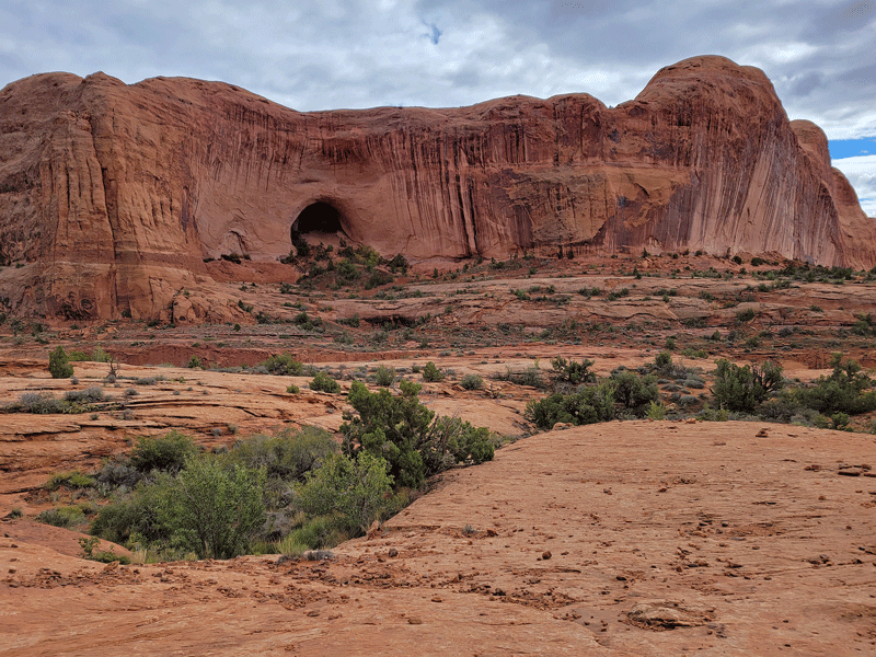
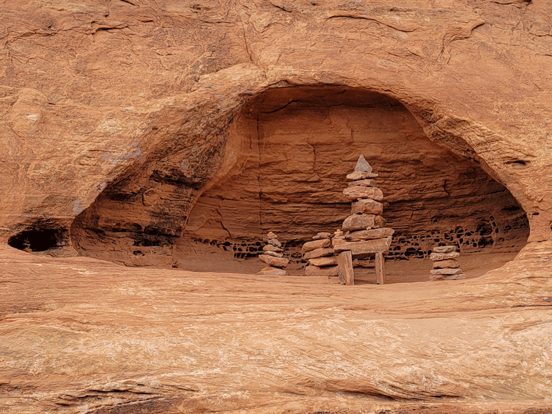
Rock cairn tucked away in a niche high above ground level 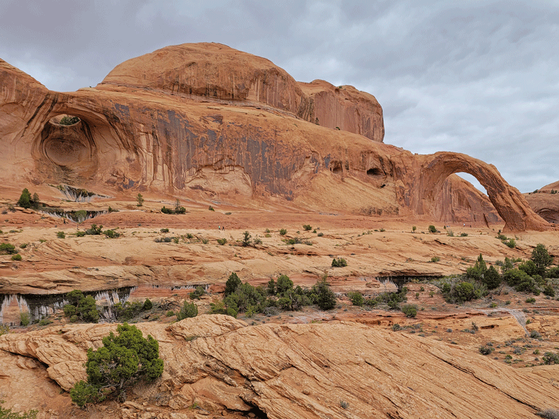
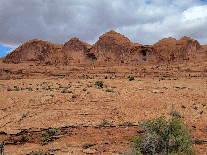
View of Bowtie Arch (left) and Corona Arch (right) 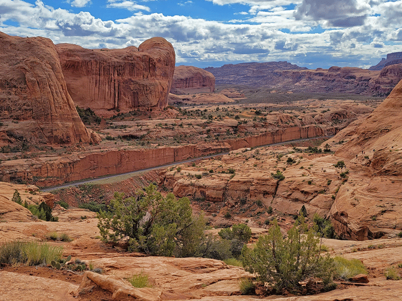
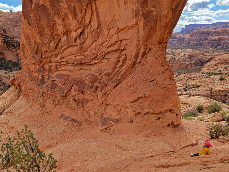
Corona Arch has a massive base (notice young girl lower right for perspective)

Top of ladder – that last step is a big one! 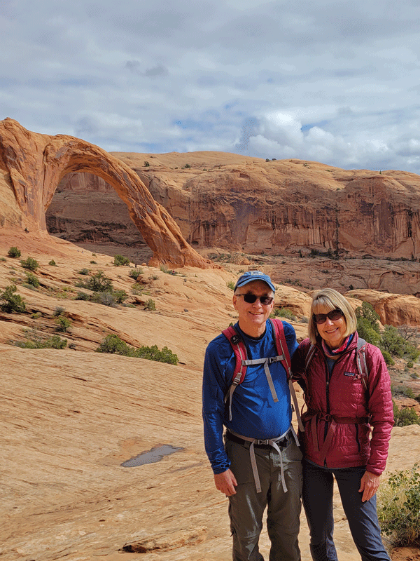
Corona Arch in the background 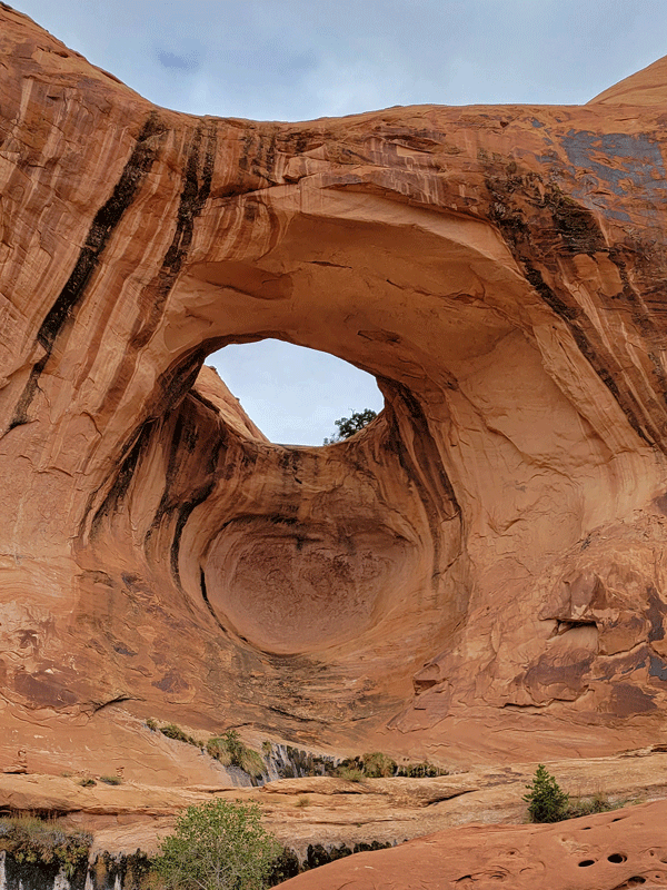
Full view of Bowtie Arch
Don’t miss this hike if you’re in the Moab area!
From a Previous Visit
I’ll wrap up with a quick mention of three highlights from a 2016 visit to Moab that didn’t get repeated on this trip but should be on the list of fun things to do.
#1 – Fisher Towers Hike

Totally awesome in every way!
#2 – Jeep Tour in Canyonlands
Our driver and guide took us on the back roads to and through a section of the park, including the steep and twisting Shafer Trail. One of our stops on the way to Canyonlands was the Thelma and Louise launching point featured in the 1991 movie.
Which also reminds me . . .
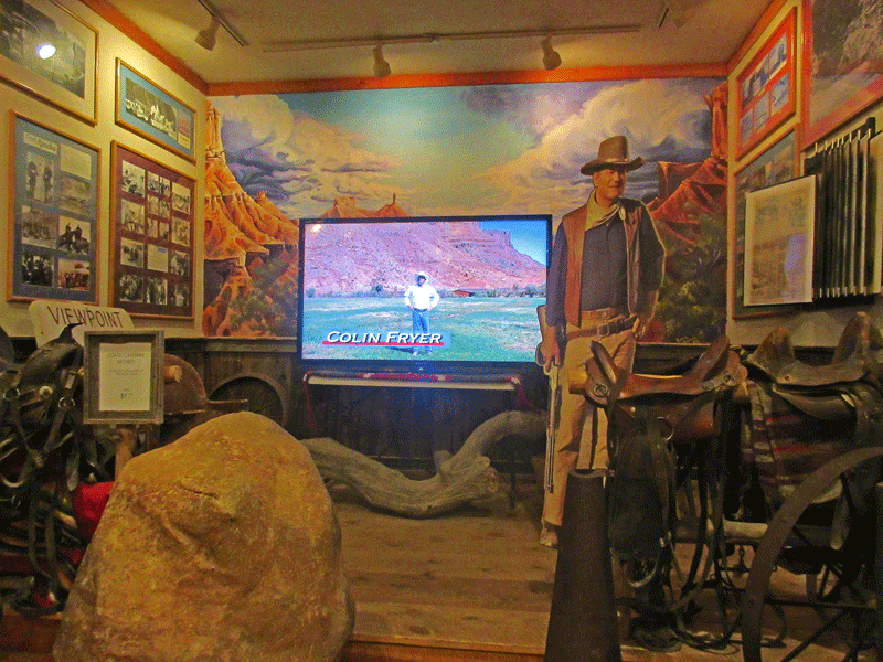
#3: Moab Museum of Film and Western Heritage
Stop in for a visit, and learn everything you could possibly want to know about Moab’s emergence as a popular filming location for movies, TV shows and commercials. Maybe even music videos, but not sure about that.
Seriously, this museum (free in 2016) will keep you entertained for hours – a great indoor activity for a day of rest or inclement weather.
Despite our misgivings about battling the crowds in Moab, we had a terrific experience. We stayed for ten days and could easily have extended for another week. An enthusiastic two thumbs up! 👍👍
Discover more from Just Passing Through
Subscribe to get the latest posts sent to your email.


Pretty sceneryâ¦..and Iâll bet the stars were gorgeous, too!
LikeLike
Especially in the parks – they brag about their “dark sky” designations. Thanks for reading!
LikeLike
I noted SO MANY of these as favorites. What a great, great trip. Keep going!
LikeLiked by 1 person